Fire, Management and Monitoring
Using fire in the Allegheny Highlands to maintain biological diversity in an ecosystem critical to climate change migration.
Key Takeaways
- Allegheny Highlands is a critical natural highway for species to move as they adapt to climate change.
- TNC uses controlled burns to mimic natural fires that shaped the landscape over 10,000 years, creating a diverse ecosystem of open woodlands, young forest and shady old-growth.
- Our efforts are enhanced by fire training exchanges (TREX) and partnerships with federal, state and private land managers.
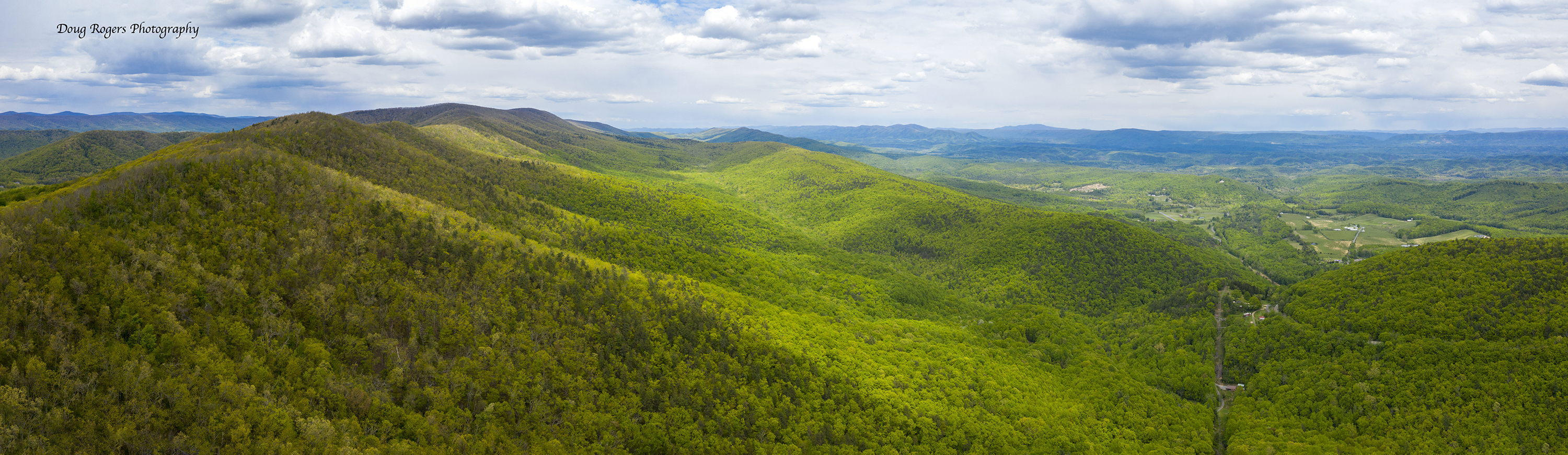
The forests of the Allegheny Highlands stretch for miles in every direction. But they also stretch back in time over 10,000 years. Throughout these millennia, fire was an ever-present force on the landscape, helping to create one of the most diverse ecosystems in North America.
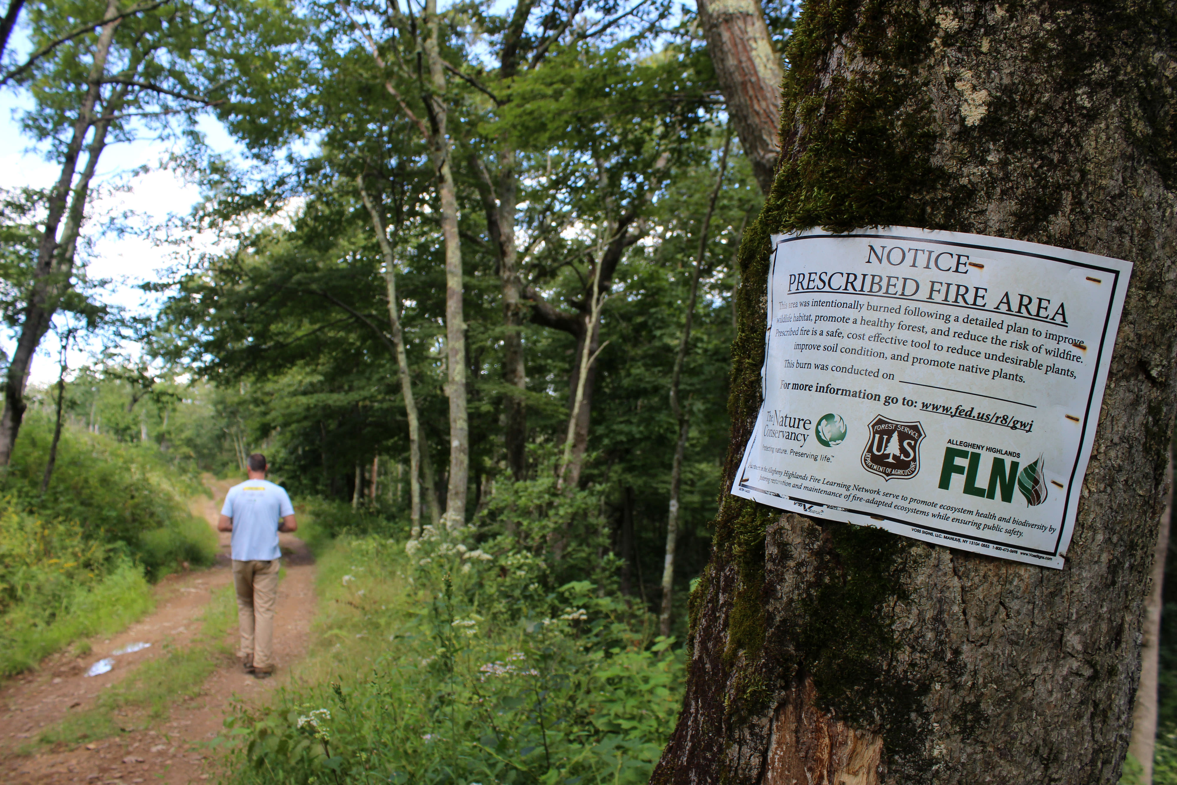
Today, fire is still an essential tool to maintain biological diversity and to reduce the size and severity of wildfires. The Nature Conservancy and our partners at the U.S. Forest Service use controlled burns on Warm Springs Mountain Preserve and throughout the George Washington National Forest to achieve ecological and human safety goals.
How Fire Shapes a Forest
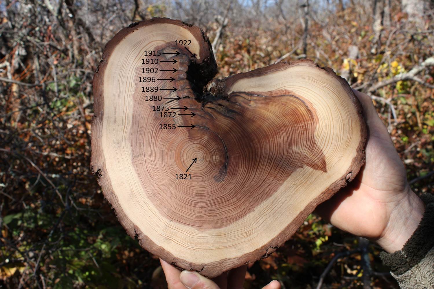
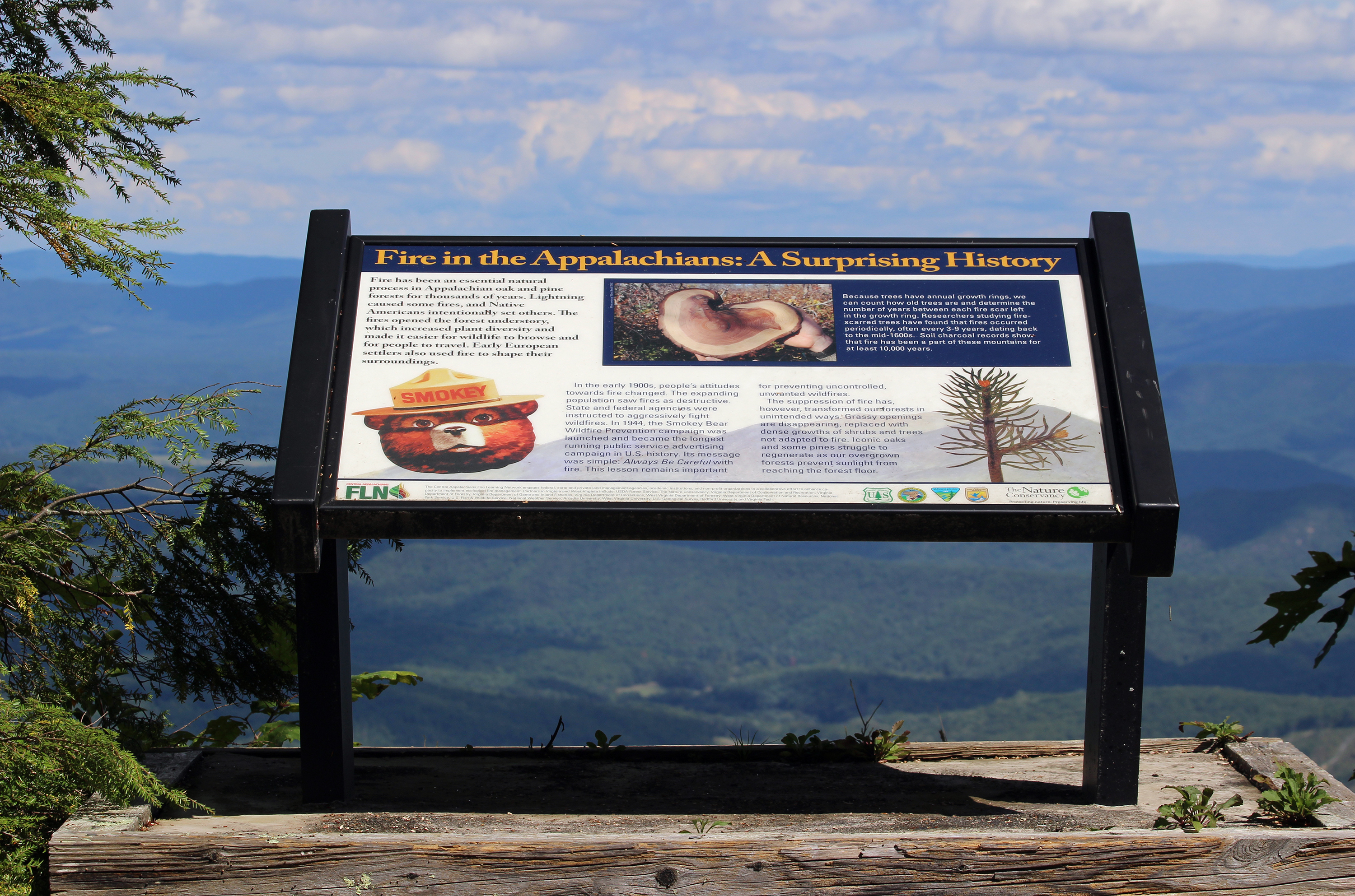
Scientists have studied tree fire scars, soil charcoal and wilderness pond sediment to piece together the story of how the Appalachian forest developed over the last 10,000 years. Comparing patterns among thousands of fire-scarred trees, researchers have found that fires occurred periodically, often every 3-9 years, dating back to the mid-1600s. Carbon dating of soil charcoal and pond sediment has allowed researchers to look back even further, confirming regular fire events during the last 10,000 years.
These historical fires were likely caused by a mixture of lightning strikes and intentional burns by Native Americans. Fires cleared out the forest floor, which increased plant diversity, improved browse for wildlife and made traveling easier. Early European settlers continued to use fire as a tool to shape their surroundings.
10,000 years of fire delivered a diverse ecosystem, filled with young, middle and old-growth forests. It contained open, fire-maintained woodlands and glades, thick with grasses, wildflowers and scattered trees. It also contained shady, closed-canopy forests, complete with their own suite of species. But overall, it was this mixture of open woodlands, young forest, and shady old-growth that made the Appalachians such a desirable home for so many plants and animals.
A Forest Without Fire
Just as 10,000 years of regular fire shaped the Appalachian forest, so has the last 100 years of fire suppression. The era of massive overexploitation in the Appalachians (1880s-1910s) included frequent, unnaturally intense wildfires, often set along new railroad systems that snaked between the mountains. Depleted resources and damaging fires were conflated and fire suppression became the new paradigm.
After the turn of the 20th century, state and federal agencies were assigned to aggressively fight wildfires. Smokey Bear was launched as one of the most successful environmental campaigns in history. This success had unforeseen and lasting consequences
Forest fire suppression, combined with past exploitative land use, has created a less diverse forest today. The more open woodland and glade habitats are virtually non-existent. An examination of the list of species of conservation concern reveals many species that are fire-adapted.
One widespread and visible example is the slow shift of dominant trees species away from fire-adapted oaks and pines and towards shade-loving—but fire-averse—maples and poplar. Across the Appalachians, scientists have documented the lack of young oak and pine seedlings—the next generation of forest.
Oak trees have adapted to fire, developing features that allow them to survive and thrive in its presence: thicker bark to withstand heat and seedling taproots to enable sprouting after fire. Even oak leaves get in on the act—they dry out more quickly than the leaves of other species, making the forest floor more responsive to fire.
Once shade-loving maple seedlings are established, they crowd out oak seedlings and become the next generation of forest when the older trees die. In the oak-dominated portion of the Appalachians, this shift away from valuable oak species will have long-lasting implications for wildlife, plants and humans.
Forests that evolved with fire cannot survive without fire; neither can the birds and animals that live there. When fire is reintroduced, plants sometimes reappear where they have not been seen for decades.
A Fire Restoration Partnership
TNC has worked hard to establish a multi-agency partnership, designed to re-establish fire on a significant portion of public lands in western Virginia. This partnership, the Central Appalachian Fire Learning Network (FLN) is a collaborative effort among federal, state and private land managers to share knowledge and resources.
Over its ten-year history, partnerships developed through the FLN have been a key component in restoring fire to the landscape at an ecologically meaningful scale. The Central Appalachians FLN covers lands in Pennsylvania, Maryland, West Virginia, Virginia and Kentucky. Key accomplishments of FLN include:
- Conducting regular burns on 130,000 acres of forest
- Development of robust fire effects monitoring programs, including for avian community, forest structure and composition and burn severity
- Mapping of ecological zones across 10.2 million acres in Virginia, West Virginia and Kentucky
- Facilitation of interagency training opportunities
- Facilitation of dendrochronology, soil charcoal and other fire history research throughout the region
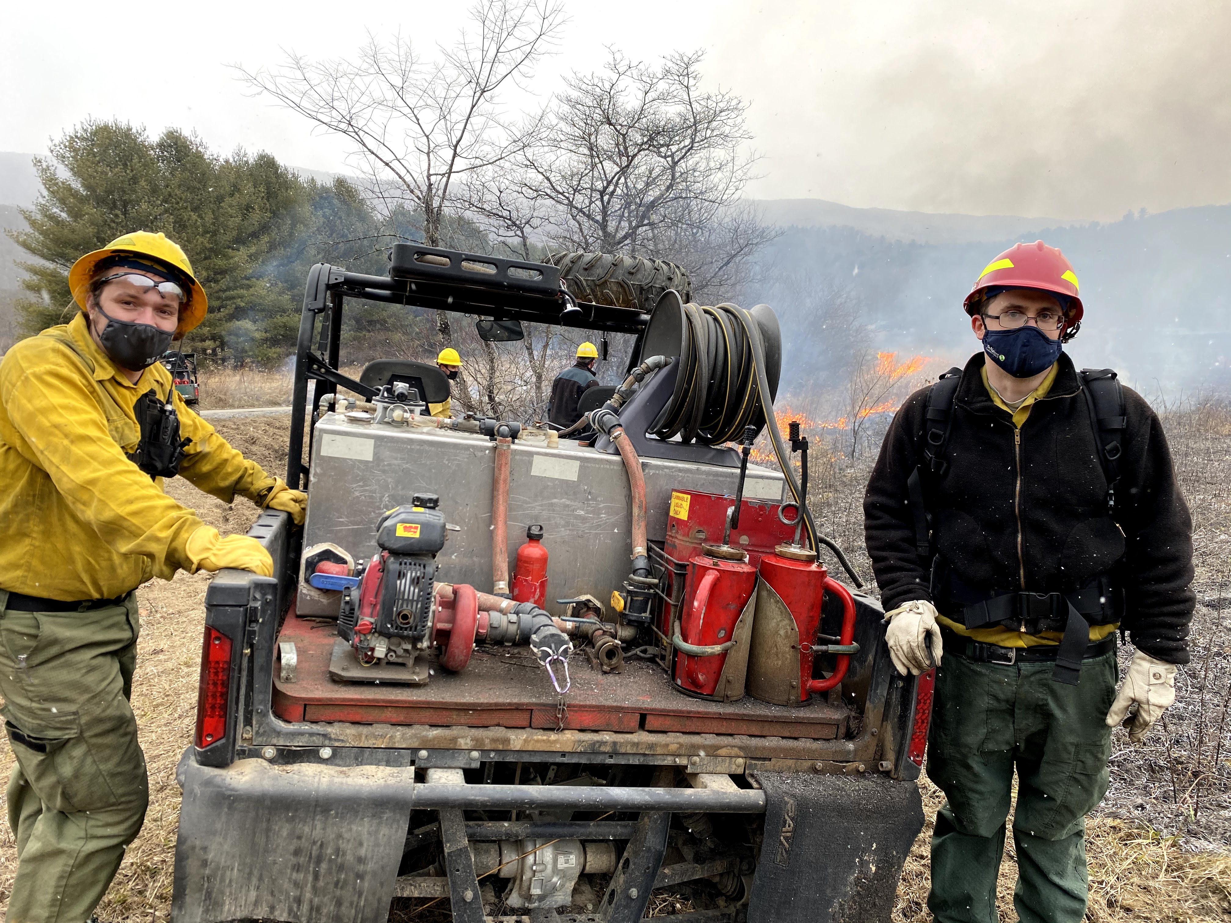
Fire Training Exchanges
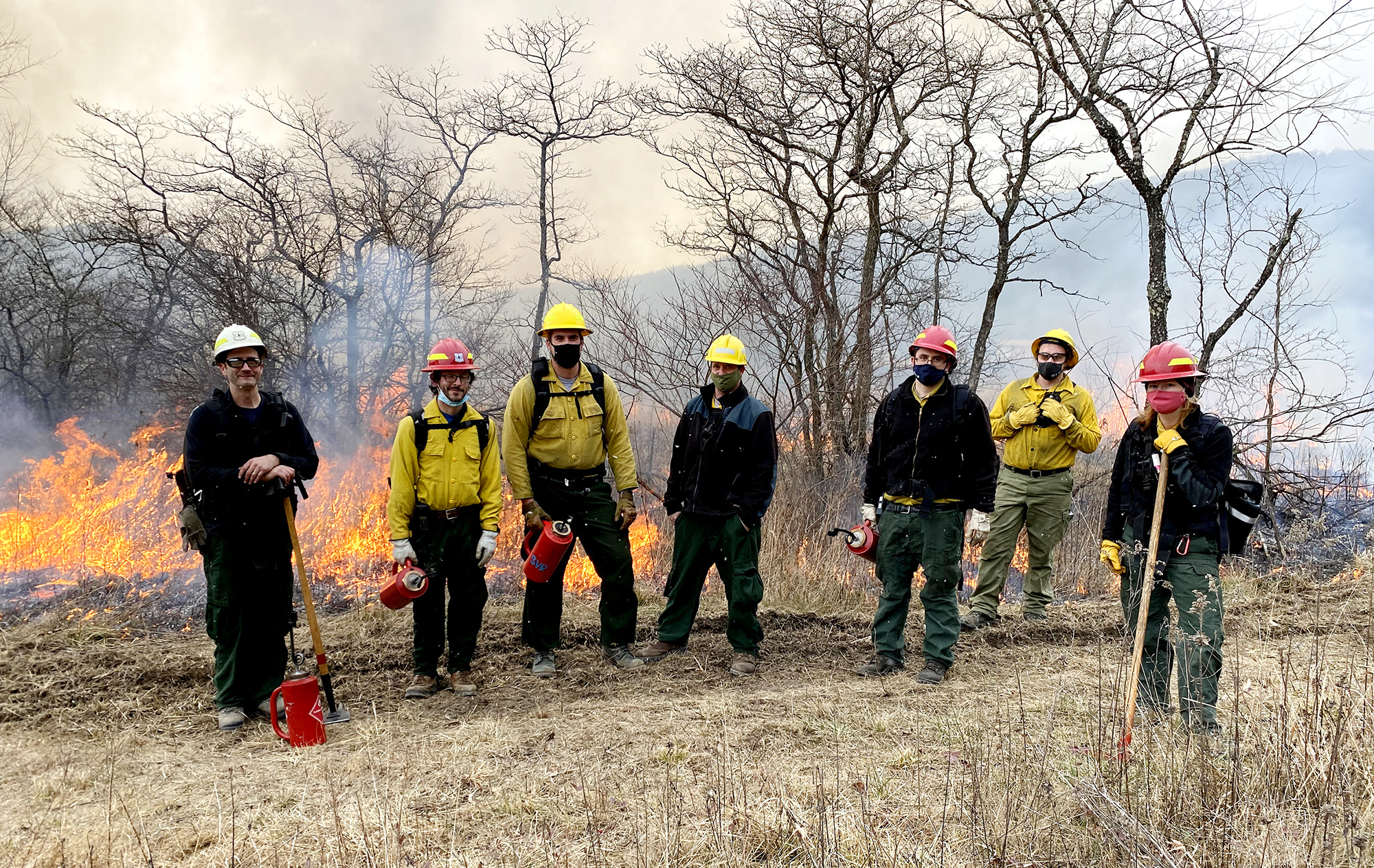
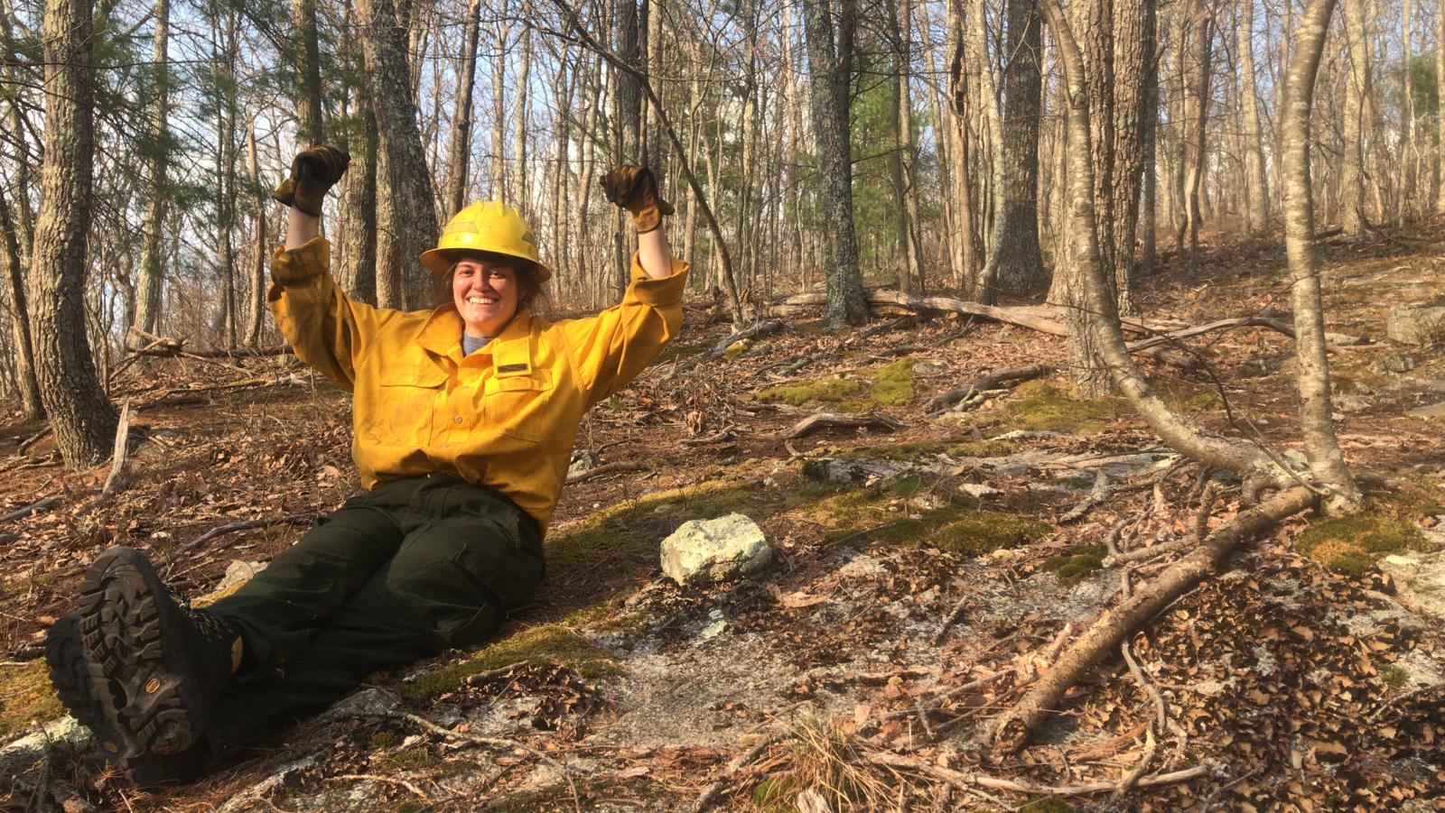
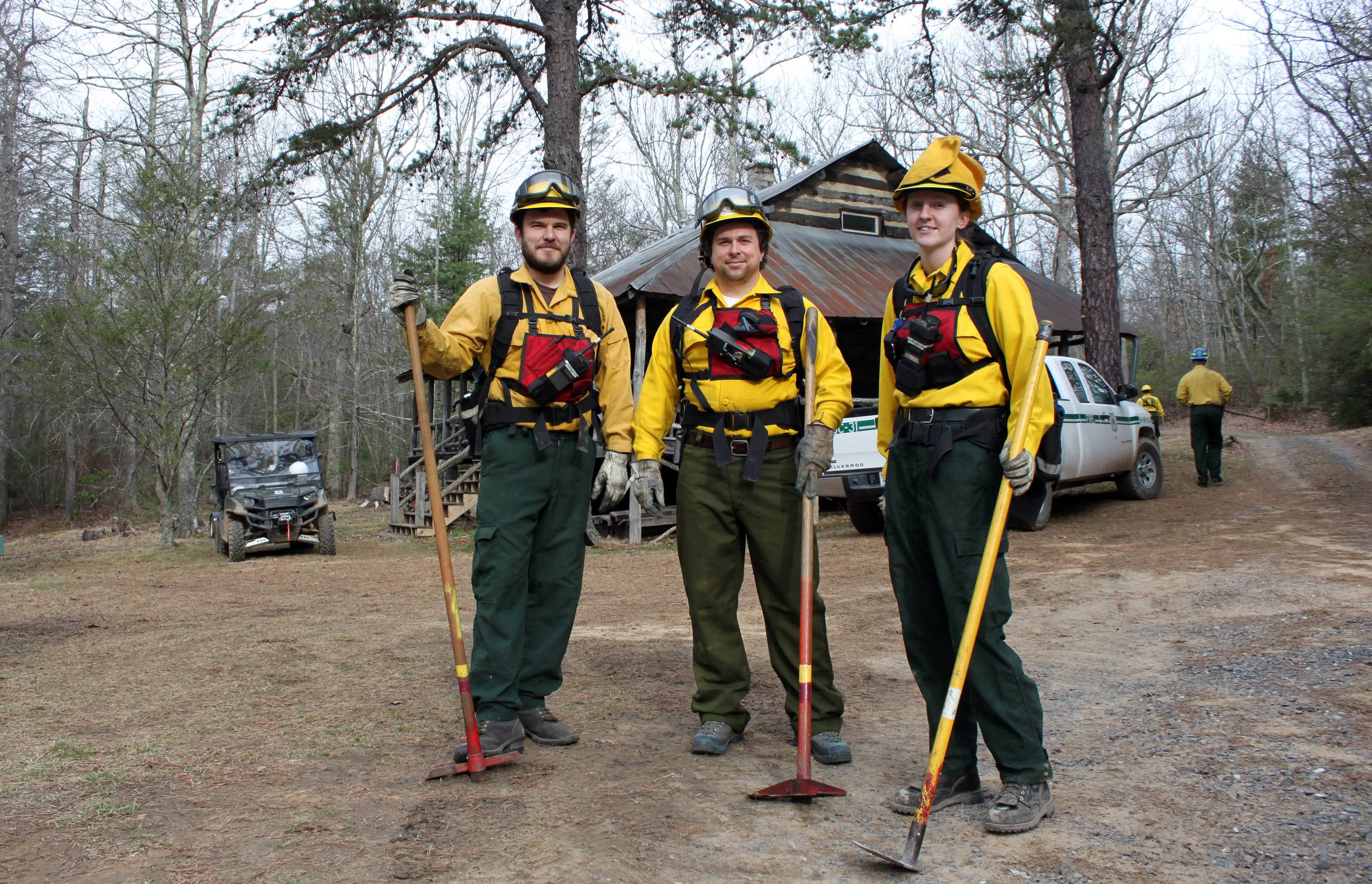
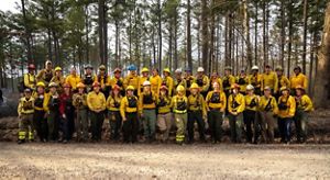
Prescribed fire training exchanges (TREX) are another way to increase staff capacity and enhance skills by delivering unique experiential learning opportunities. In March 2014, the Allegheny Highlands program hosted the first eastern U.S. TREX. Participants from a wide range of organizations and states gained valuable experience while assisting Virginia partners with their controlled burns.
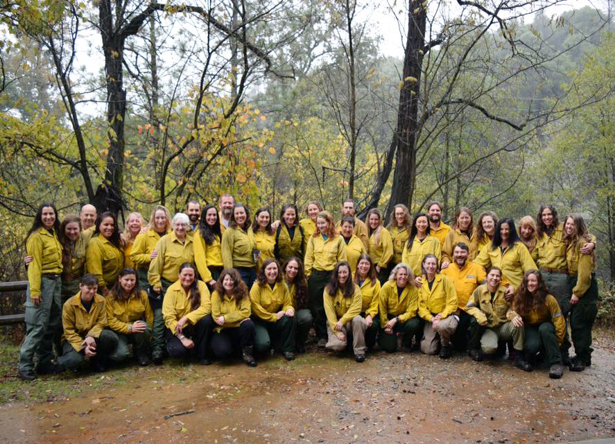
Women have traditionally been an underutilized resource in fire management. The Women in Fire TREX (WTREX) program aims to connect women who work in fire, providing mentoring and networking opportunities and increasing diversity and inclusion in the fire management workforce. Virginia’s Nikole Simmons is a leader in the program which began in 2016 and came to Virginia's Piney Grove Preserve in 2022.
Planning and Conducting Burns
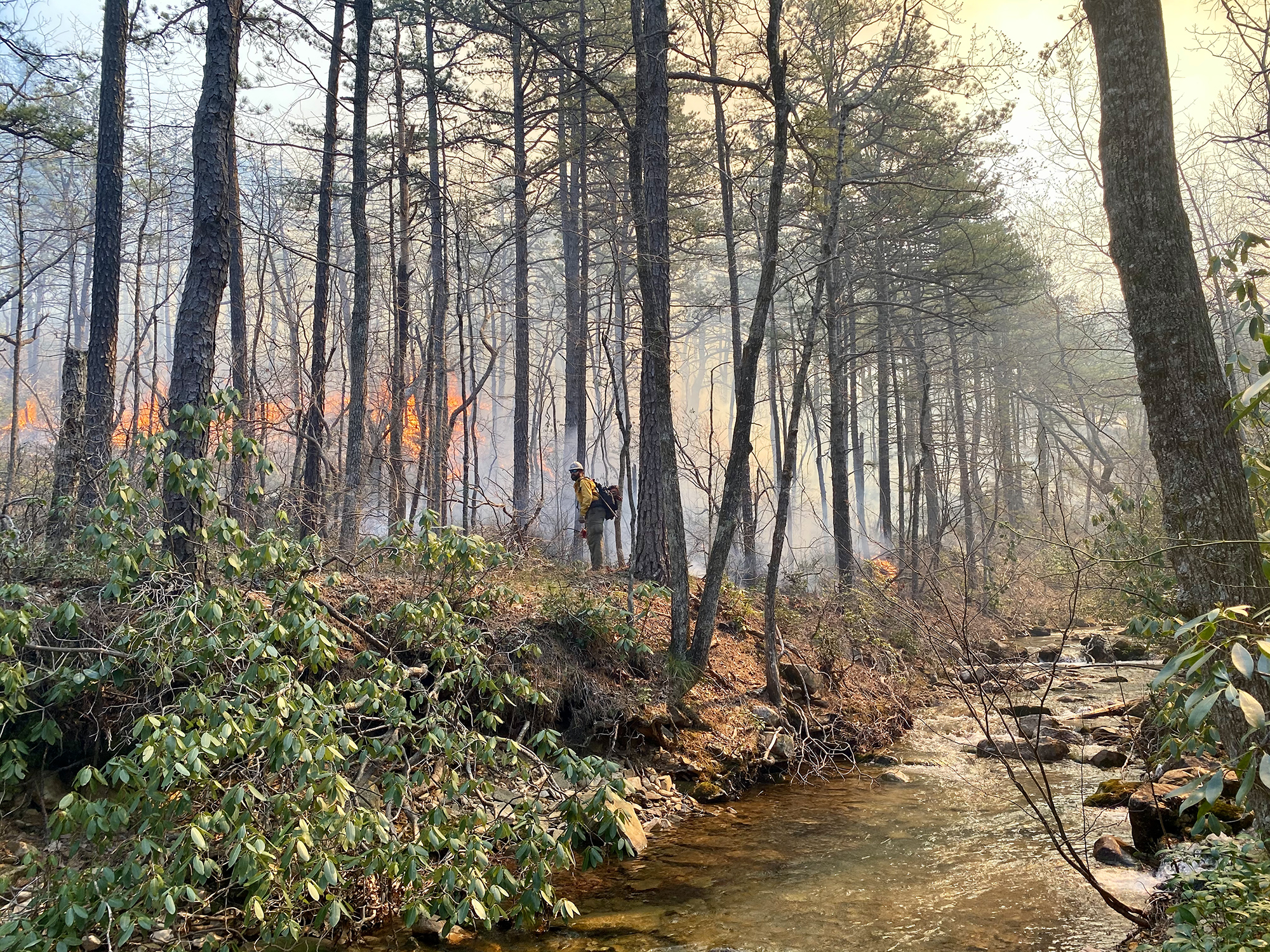
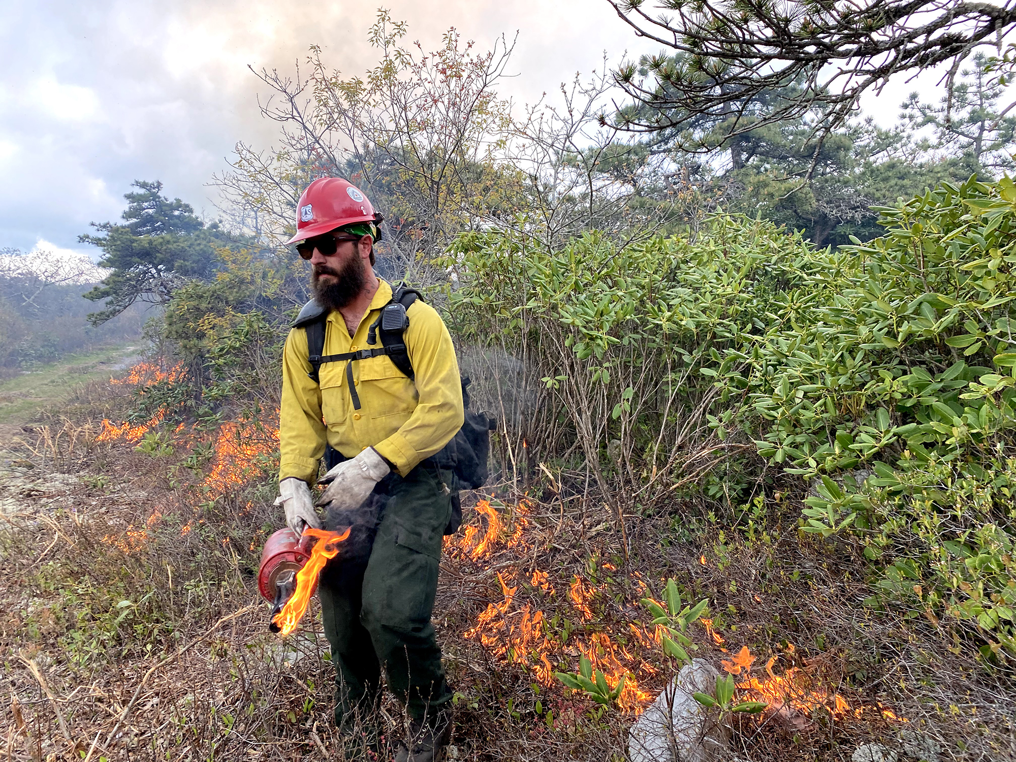
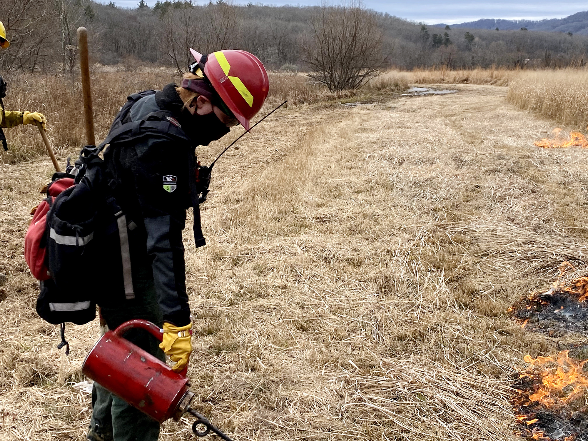
In the right place at the right time, fire is a land management tool that can offer numerous benefits to people and wildlife. Controlled burns are carefully planned. They take place only when the weather conditions are best to control smoke, manage fire behavior and ensure the safety of the fire team, nearby residents and private property.
Prior to lighting the burn, crews construct and designate firebreaks to help ensure the fire does not leave the burn area. Firebreaks are corridors around the burn where vegetation has been removed. Roads, trails and streams also make good firebreaks.


Fire Technology
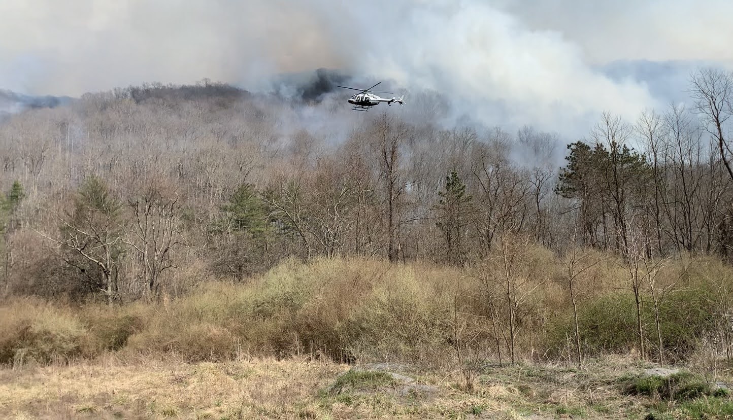
Ignition of controlled burns is often done by hand, with crew members using drip torches. For larger burns, and to maximize the safety of ground crews, a helicopter is used for aerial ignition. A PSD (plastic sphere dispenser) activates and spits out chemically treated spheres resembling ping-pong balls. Upon landing, each sphere bursts into a small ball of flame.
In 2021, Virginia's fire team began using a drone for aerial ignition. An immediate benefit was increased safety as the drone was able to replace many inherently risky helicopter flights. It also easily accesses terrain that is treacherous for crews on the ground to reach, and its imaging technology gives the pilot an eagle’s-eye view of the burn operation.
Setting Records for Restoration
Burning at scale allows us to achieve a range of ecological effects, including improving the condition of fire-adapted forest types, wildlife habitat enhancement and fuel reduction.
Following a long hiatus due to the pandemic, TNC and partners resumed controlled burning in 2021. Good weather, the maturation of our partnerships and everyone’s burning desire—pun intended—to get back to work contributed to setting records for the number of acres burned across the Central Appalachian Mountains.
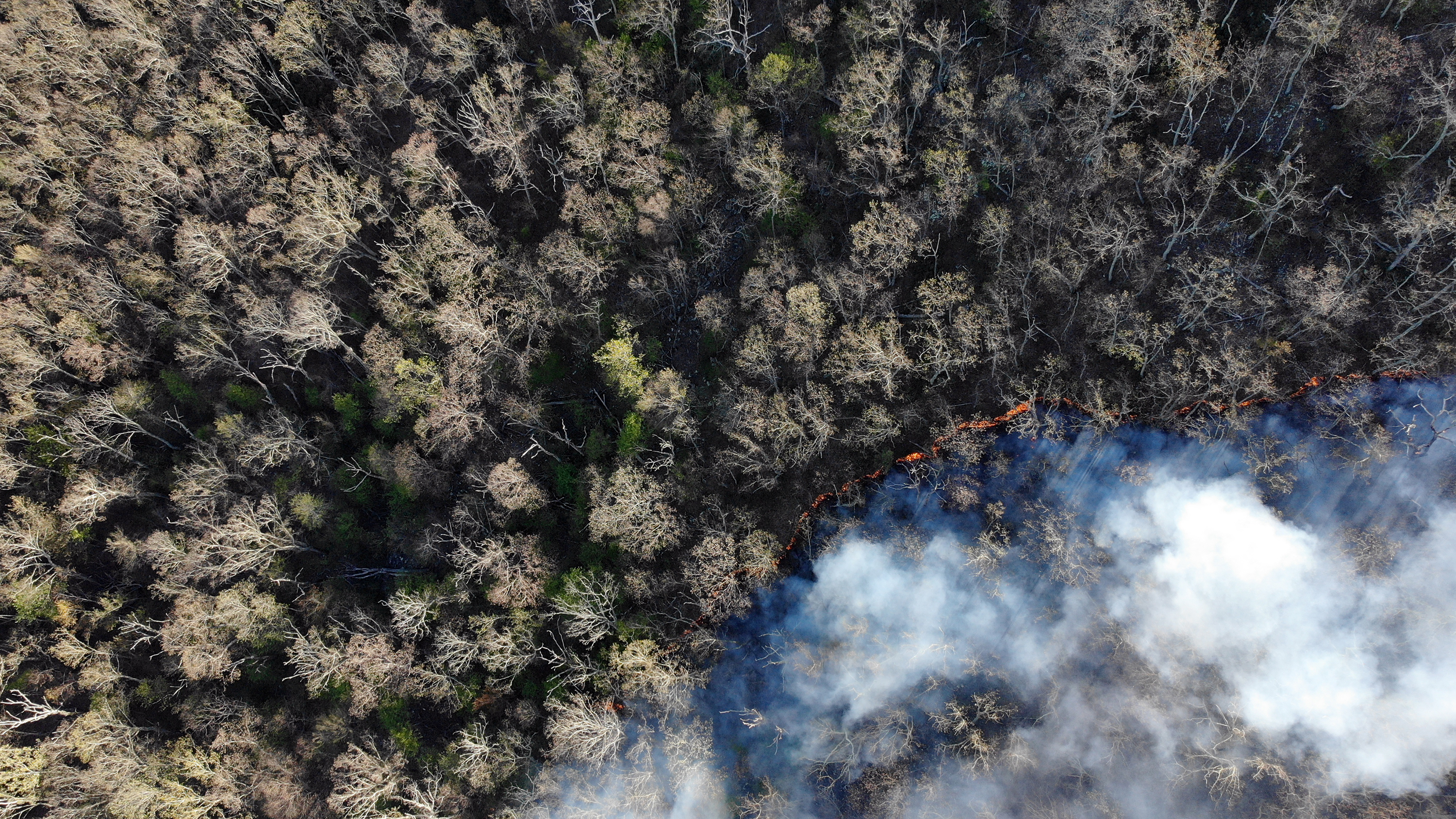
During spring 2023, TNC fire teams joined with our state and federal agency partners to complete the largest-ever controlled burn across TNC and national forest lands in Virginia. Our partnership—Heart of the Appalachians Fire Learning Network—applied fire to 7,300 acres across the aptly named Big Wilson and Porter’s Mill burn units. The record-setting burn was both a milestone for a years-long investment in forest restoration and a new beginning.
After the smoke clears and the fire teams head for home, our forests get to work on regeneration. Within days, new life will appear. The forest’s response, in turn, sets in motion new seasonal cycles of scientific inquiry into the effects of fire and how restoration is progressing toward desired healthy conditions.
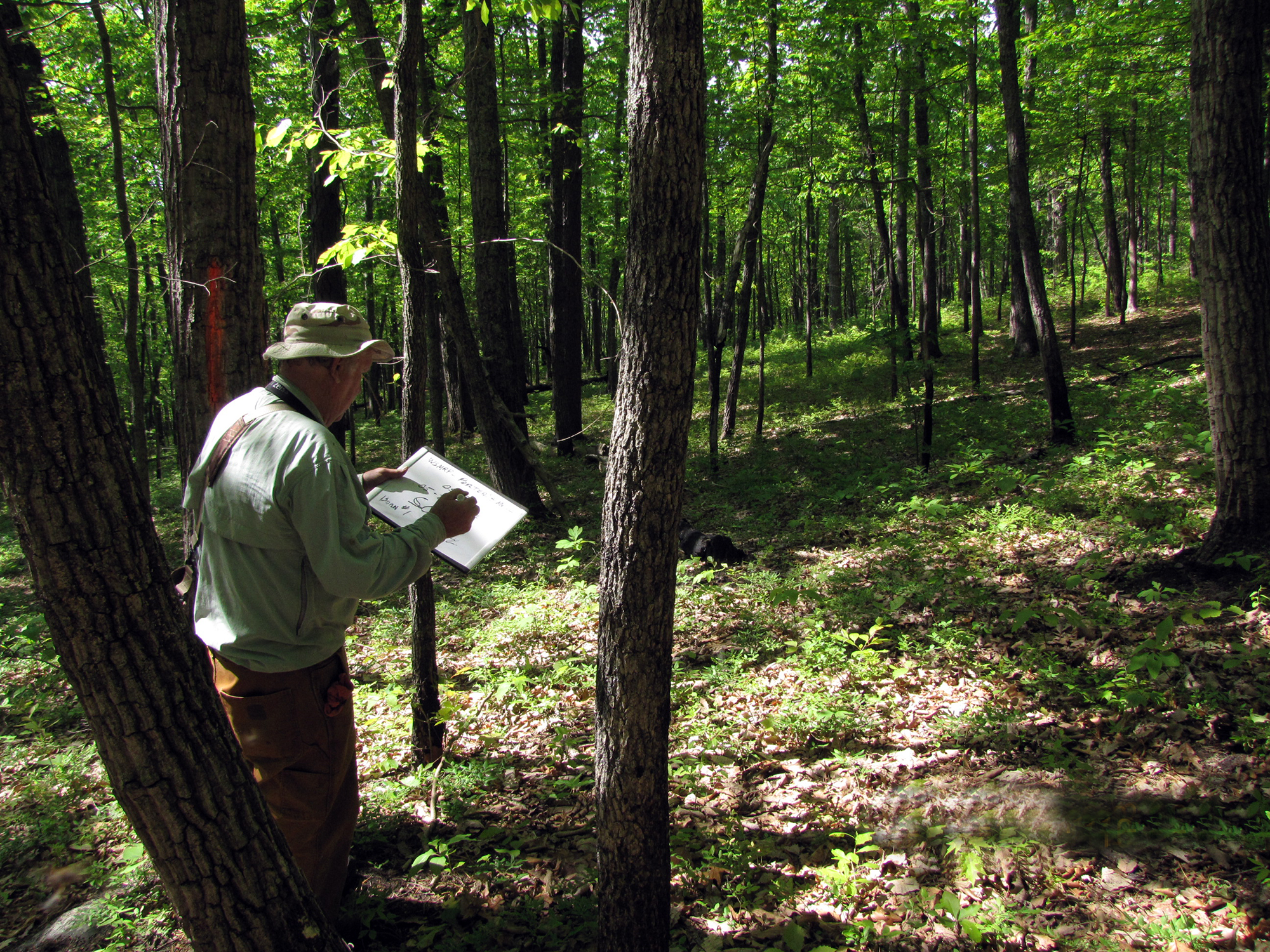
What’s best for biodiversity is a forest with a mosaic of habitats and structures, from sunny to shady. Burning allows us to recreate the missing parts of that mosaic. Along with assessing forest patterns via satellite imagery, our Allegheny Highlands staff return periodically to burned areas to inventory songbirds and monitor plant growth.
The plots that resound with the most bird song are often those entangled in blackberry brambles and other thick understory cover important for many species. It can take 10 minutes to travel 20 yards through some of the habitat.
Some of these adventures require chainsaw chaps for protection against the vegetation, while others offer a peaceful stroll through open forest. Gaps in the canopy encouraged by fire allow more sunlight to reach the forest floor and new grasses and flowering plants to grow.
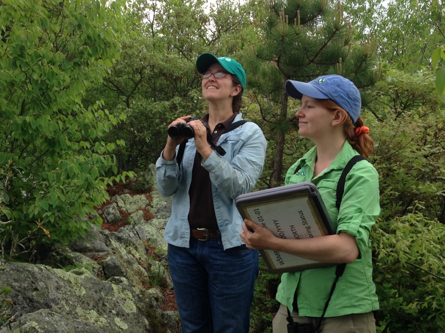
Bird Monitoring in the Allegheny Highlands
Understanding how fire affects plant and animal communities is an important part of our conservation efforts. In 2011 the Alleghany Highlands Program began a long-term study of the response of bird communities to landscape-scale burning over time.
The monitoring area spans 18,000 acres of contiguous lands owned by TNC and the George Washington and Jefferson National Forests and samples from a set of 107 permanent plots established for pre- and post-burn forest structure and composition monitoring.
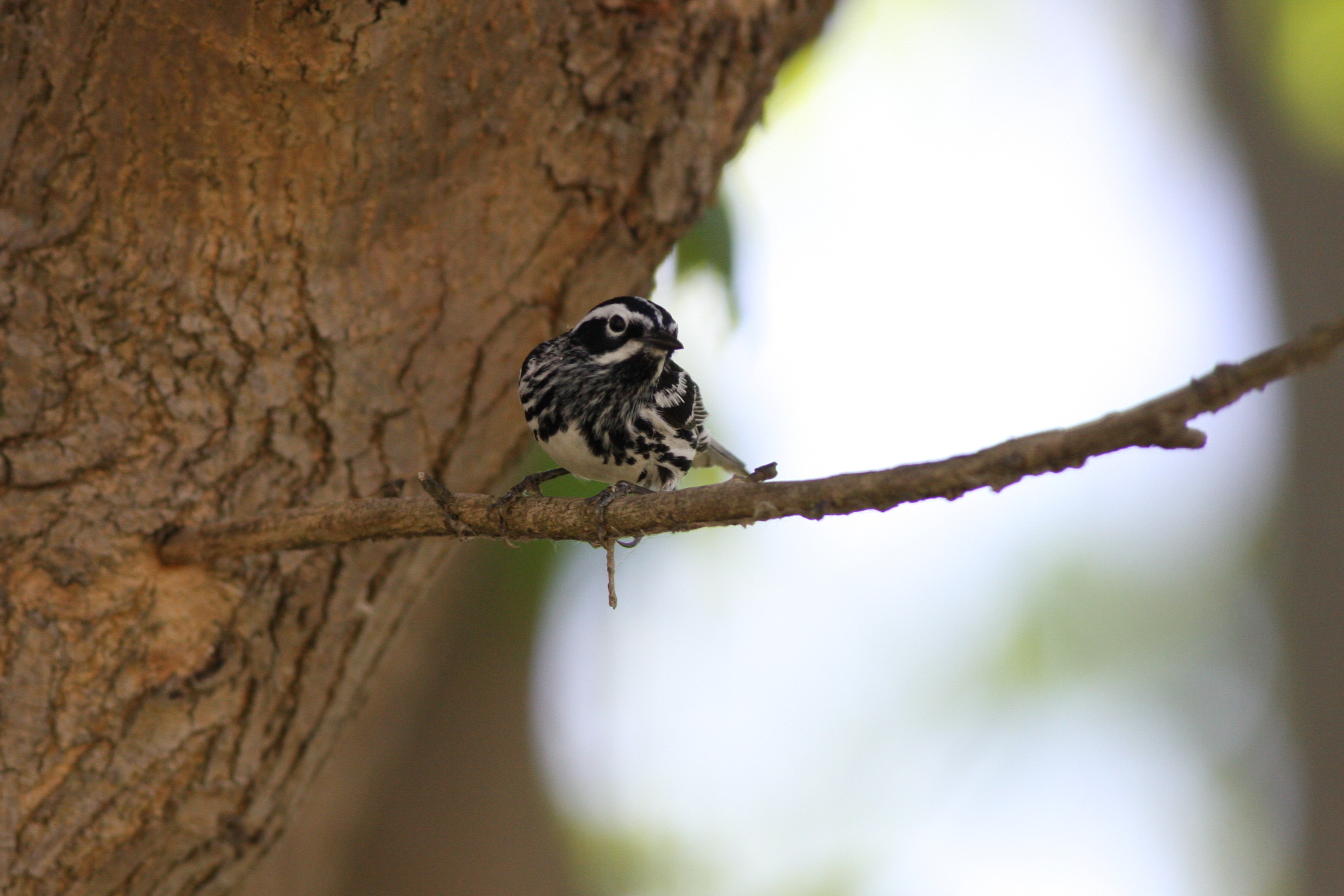
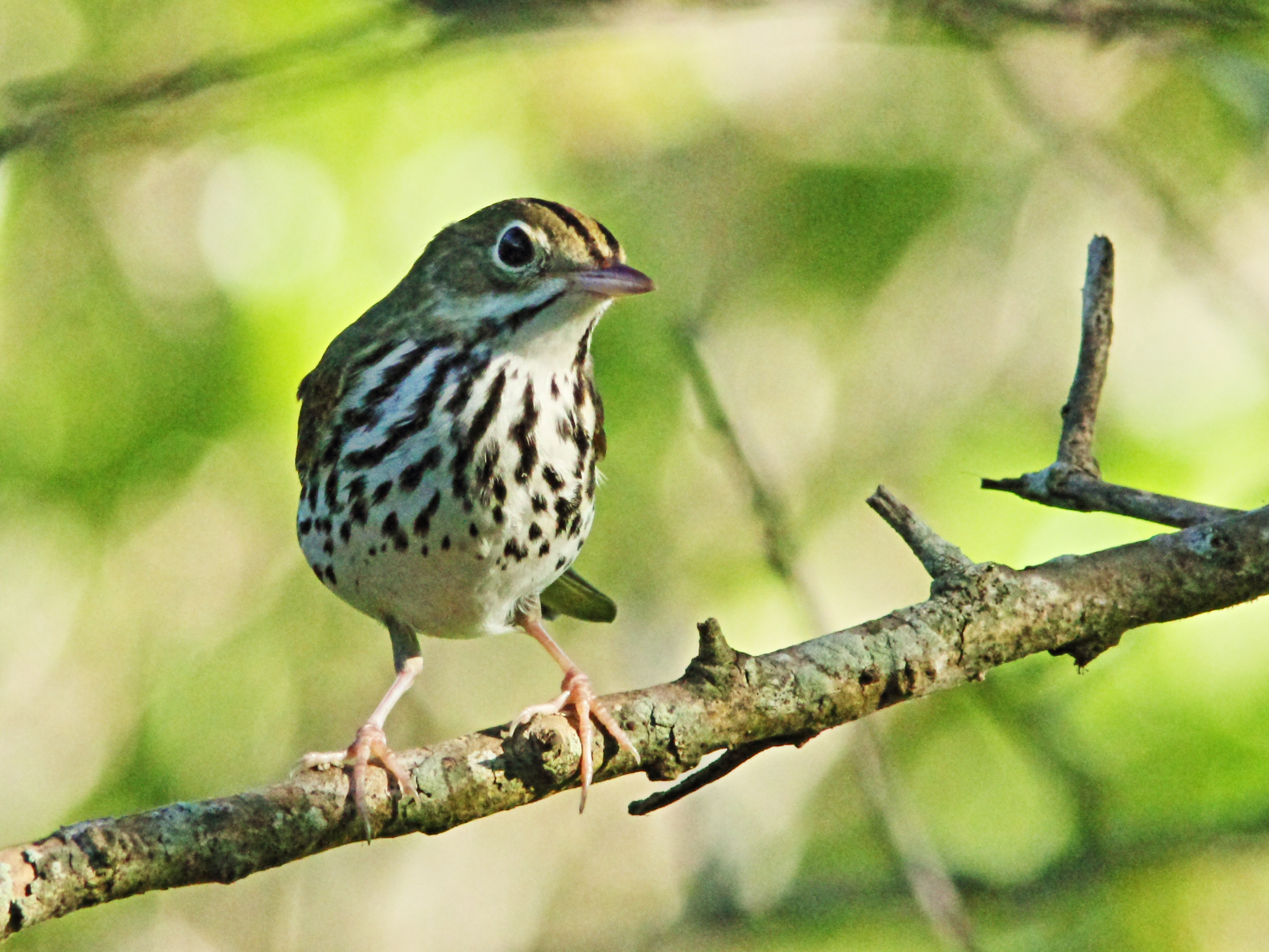
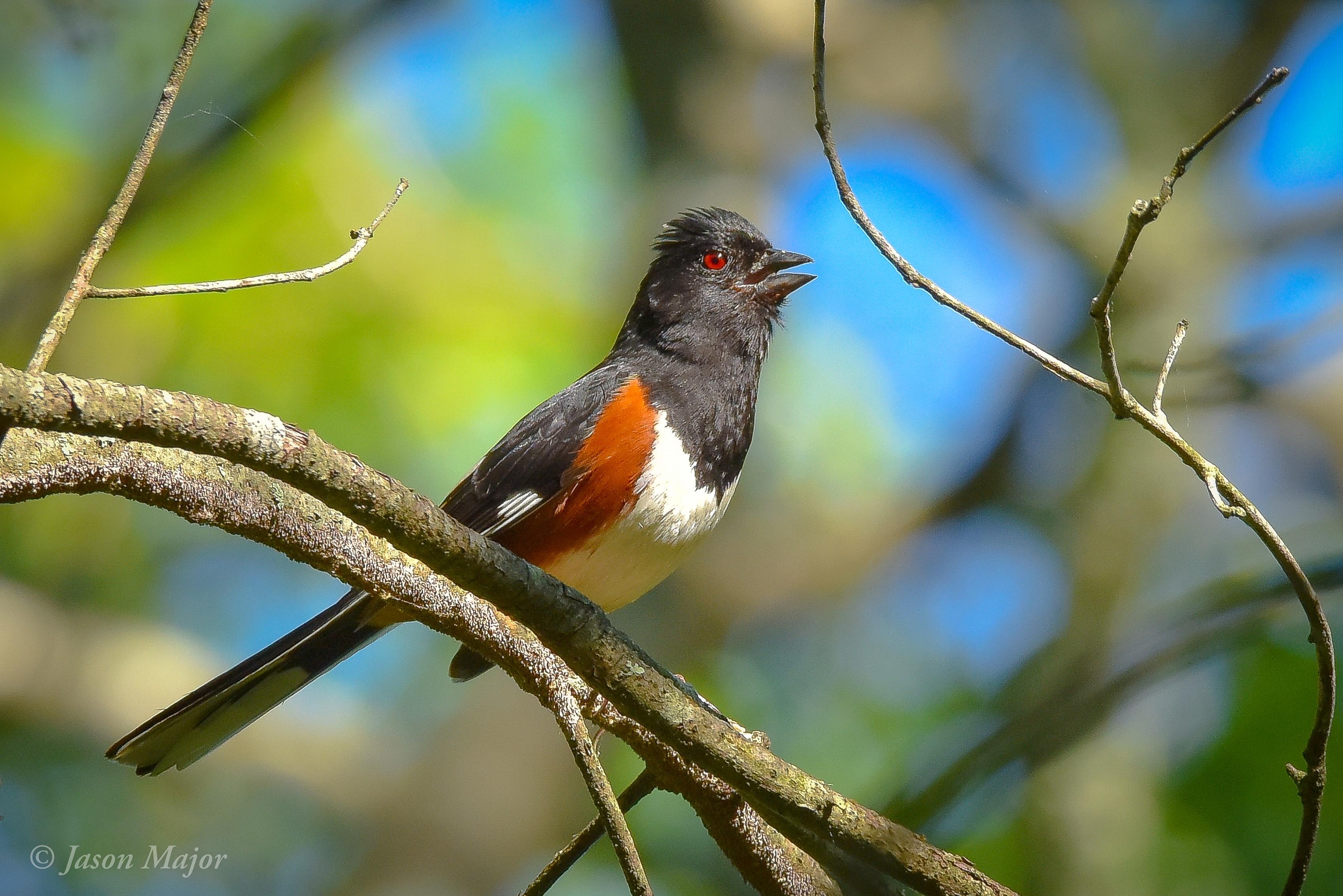
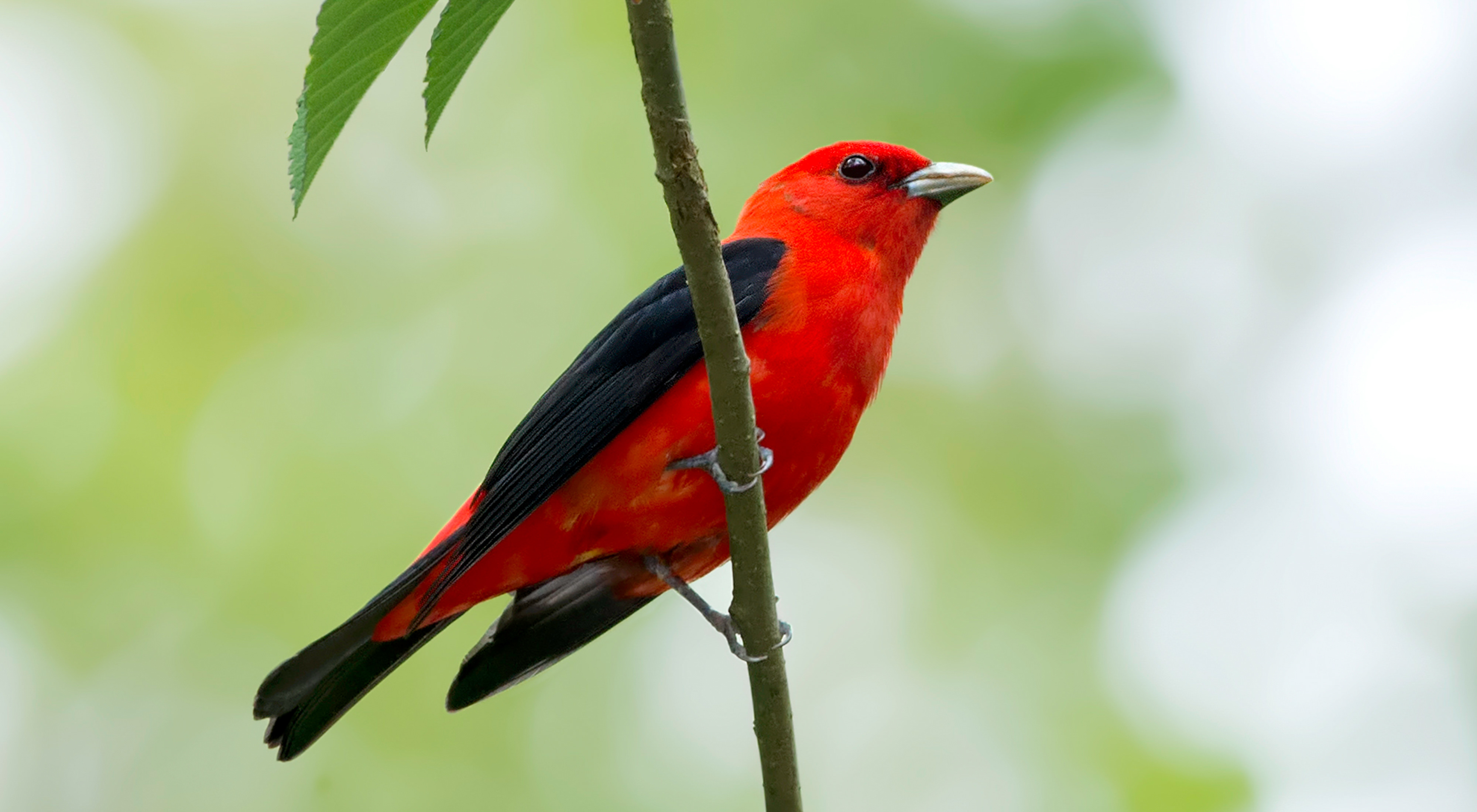
Although each bird recorded in this survey is significant, seven focal species are of interest: Scarlet Tanager, Eastern Wood-pewee, Black-and-white Warbler, Hooded Warbler, Worm-eating Warbler, Ovenbird and Eastern Towhee.
Listening and Learning
Surveys are conducted from mid- May through mid-June—the peak breeding season. Birds are recorded in one-minute intervals for ten minutes at each survey point.
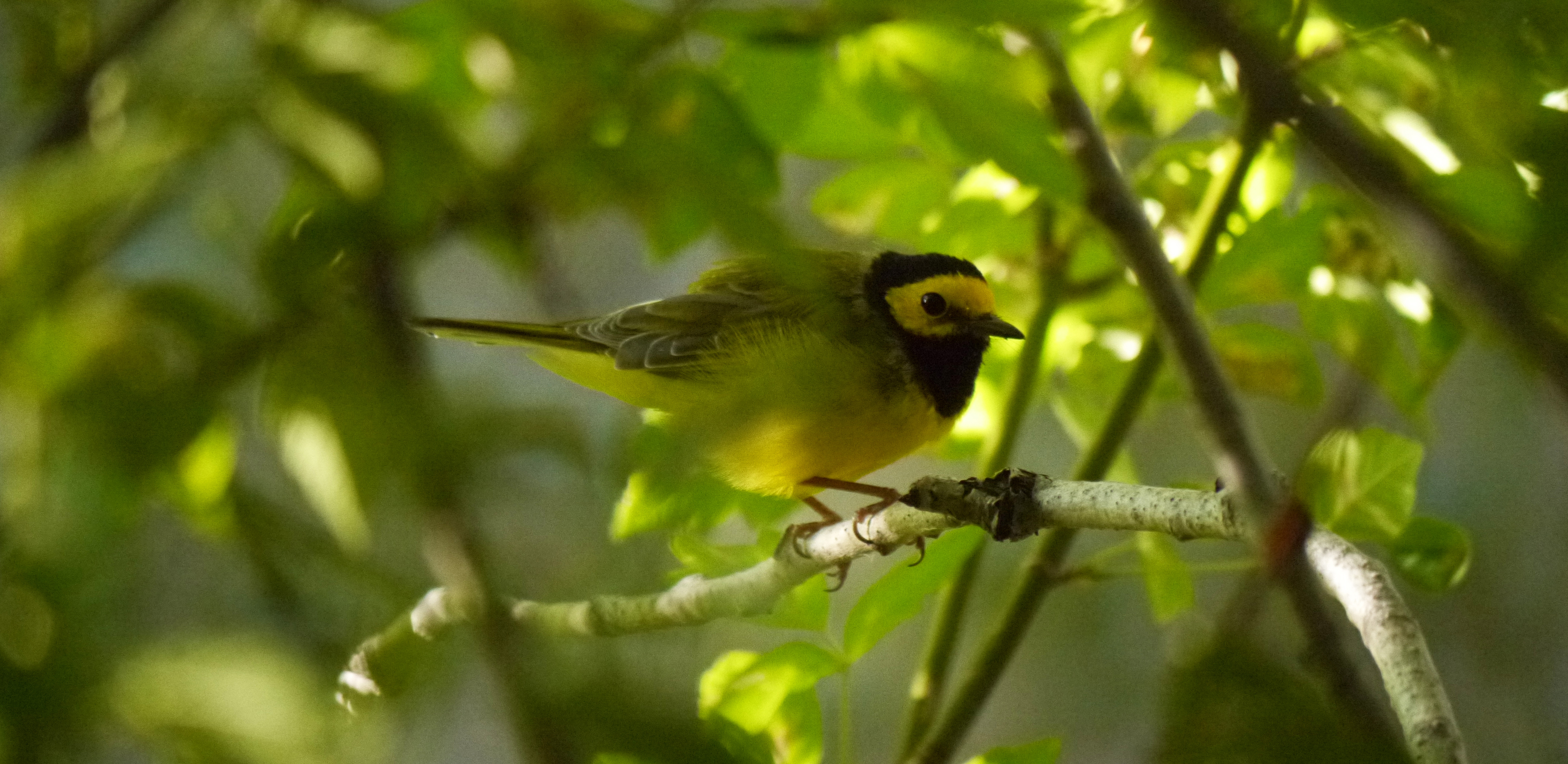
Hooded Warbler : (Setophaga citrina)
These birds were chosen for their abundance, high detection probabilities, foraging niches and nesting habitat preferences. Estimated population trends for these species may indicate changes in habitat condition and help inform our land management decisions.
Preliminary results from this ongoing study suggest that, although focal species may have positive or negative responses to a single controlled burn, they remain resilient both in geographic space and over time as the overall bird diversity in the project area increases.


Animals and Fire
Animals may be temporarily displaced following a prescribed burn, but most can avoid direct harm from fire. Deer run; birds and bats fly; and mice, lizards, snakes and salamanders go underground into burrows or under rocks as a fire approaches.
Ironically, the absence of fire may cause greater harm to wildlife. Habitat changes resulting from fire exclusion can result in low reproduction and eventual displacement of some wildlife. Today many wildlife species are imperiled by habitat changes resulting from too little burning.
Acorns, blueberries and blackberries are important food sources for white-tailed deer, wild turkeys, black bears, songbirds and many other wildlife species. Fire increases fruit production in some plants and helps improve seed germination for others.
The diversity of young and old trees, and open and closed canopy conditions created by fire, provides a greater array of habitats for different species. Songbirds, for example, partition forest resources by dividing up the height at which they nest and find food: from scarlet tanagers nesting and foraging in the canopy to ovenbirds making their living on the ground.
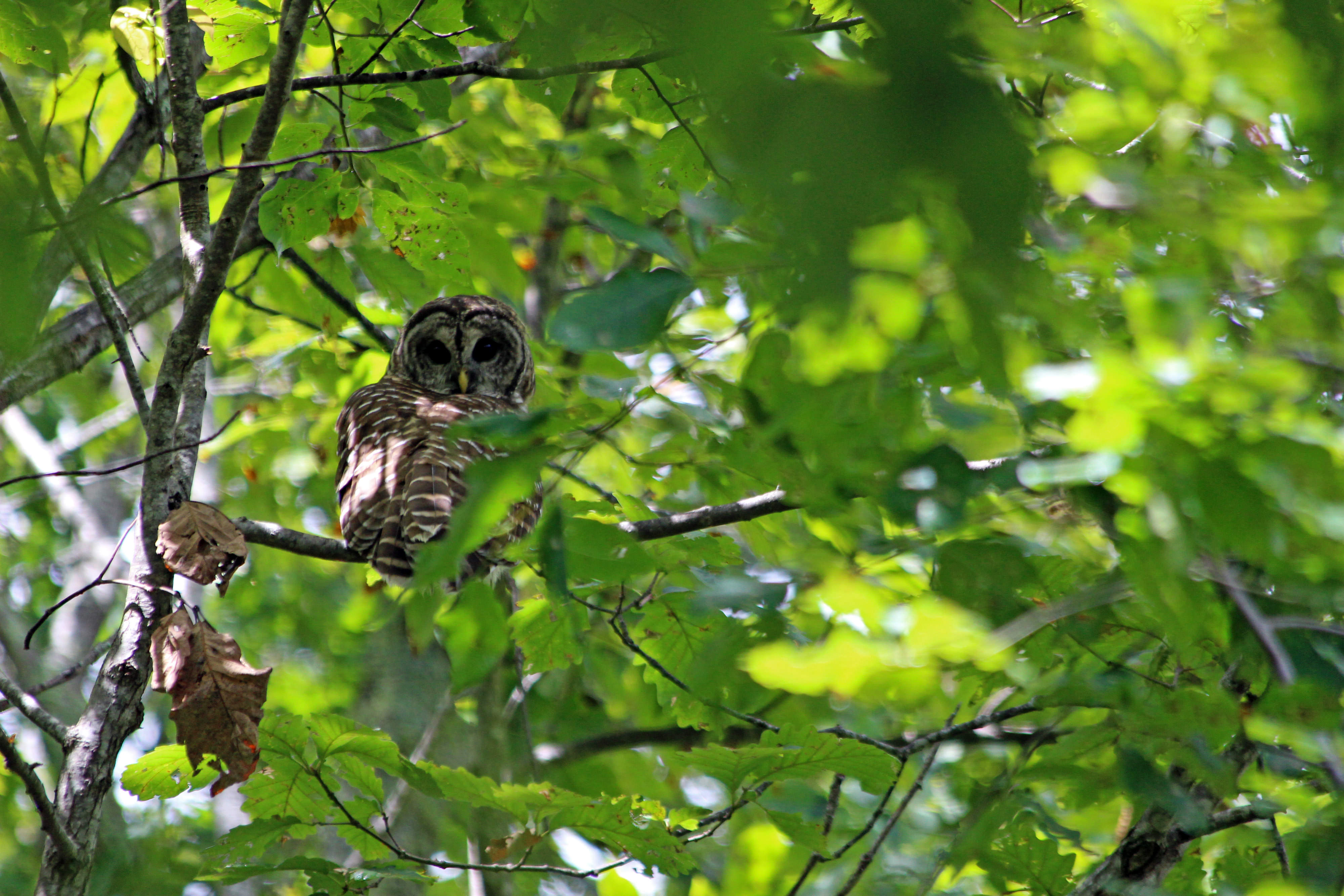
Standing dead trees, or snags, created by fire are invaluable to woodpeckers, barred owls and other cavity nesting birds and used as den trees by black bears, bobcats and raccoons.
Overall, fire creates a complex mosaic of different habitats and food resources leading to a more biologically rich and diverse natural area.
We Can’t Save Nature Without You
Sign up to receive monthly conservation news and updates from Virginia. Get a preview of Virginia's Nature News email

Take a Closer Look

Warm Springs Mountain Preserve
Explore this 10,000-acre preserve in the heart of the Allegheny Highlands.
Trailblazers: Women in Fire
Female fire professionals are blazing new career trails while harnessing the power of fire to restore forests.

Virginia’s Public Lands
Celebrating the contribution public lands make to Virginia’s natural heritage, culture and economy, and the role TNC has played in protecting them.