Conservation Technology
Working with California’s most abundant resource: Innovation.
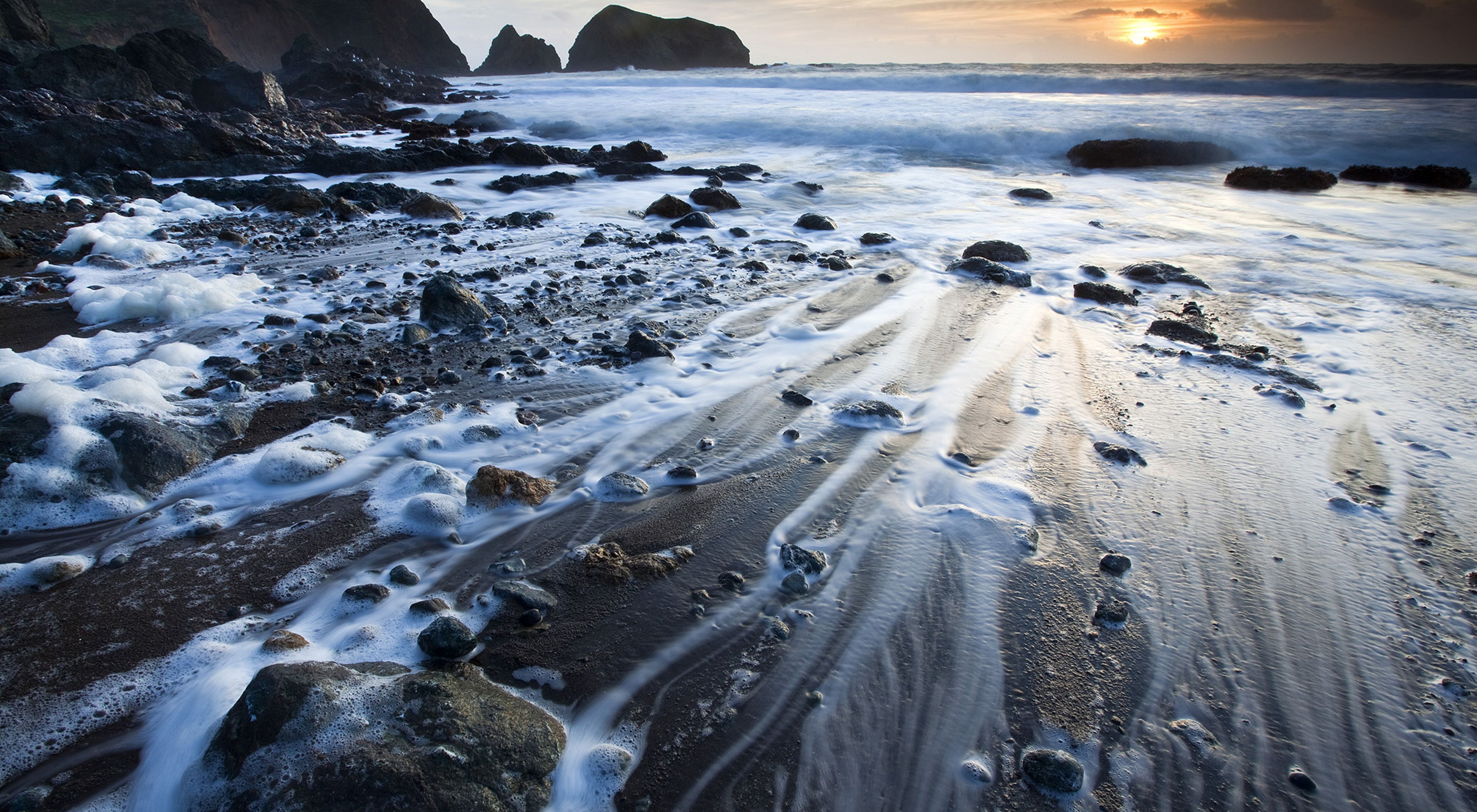
It’s time to design a sustainable California.
California is the innovation hub of the world. It's a state of inventors, entrepreneurs and cultural game-changers, and the technologies we make here are transforming the human experience. Now, there is a new client that could use the help of the tech sector: Nature.
The Nature Conservancy in California is piloting technology for conservation because we know that when we protect nature, nature protects us.
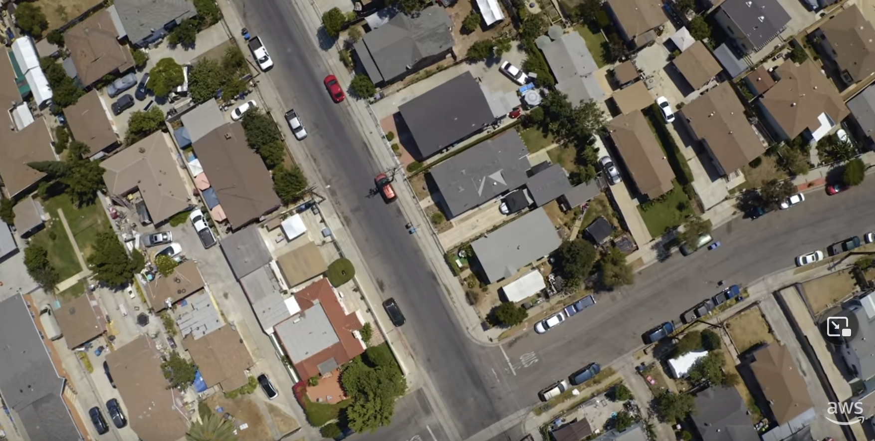
Remote Monitoring in California and Beyond
Monitoring TNC’s many hundreds of preserves and conservation areas is time-consuming, expensive, and logistically challenging. So we partnered with Upstream Tech, a conservation-focused software development firm, to build a web-based platform called Lens that allows us to monitor our entire portfolio of properties via aerial imagery by comparing current and historical imagery.
TNC’s other state programs, as well as many land trusts, struggle with the same monitoring problem. In 2020 and 2021, we extended training, support, imagery and online access to other TNC state and national chapters. The results have been remarkable: remote monitoring with Lens resulted in an average 28% reduction in costs and a 57% savings in personnel time. These savings can be redeployed towards more strategic conservation work.
In response to high demand from the greater land trust community, we published a whitepaper on Lens and shared our research and lessons learned. Additionally, we partnered with the 1,000+ member Land Trust Alliance to launch a two-year grant program, helping the land trust community integrate remote monitoring into their business practices.
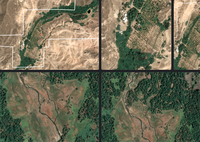
Meet Conservation's Eye in the Sky
At TNC, monitoring conservation properties can be a big job, but new technology is making it easier. TNC collaborated with Upstream Tech to develop Lens, a platform for monitoring natural lands remotely using satellites. This technology was a game changer and now, over 150 orgs have adopted Lens. Click through our slideshow and see for yourself!
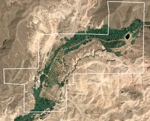
Desert Oasis: Satellite image of a date farm along a stream in the Amargosa Desert in California. © 2019 Airbus
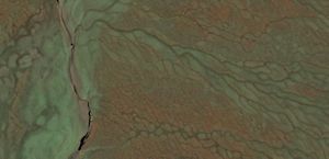
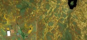
Ranch from Above: Satellite imagery of a stream with drainages on a California conservation ranch. © 2020 Airbus Pleiades
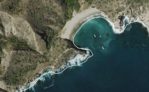
Santa Cruz Island Shoreline: Aerial imagery of boats on the shores of Santa Cruz Island. The property boundary is displayed as a white line. © 2014 USDA NAIP
Wildflowers for Miles: Satellite imagery of grassland wildflowers in California. © 2021 Airbus Pleiades
From Months to Minutes: Pioneering New Technologies to Protect Island Biodiversity
The problem with Islands: Islands represent only 5% of the earth’s land area, and yet they are some of the most biodiverse regions on earth. They link together the world’s oceans and support the health and livelihoods of communities worldwide. Unfortunately, islands are also extinction hotspots. Invasive species and habitat have dramatically transformed shocking numbers of island landscapes, culminating in species loss and ecosystem collapse.
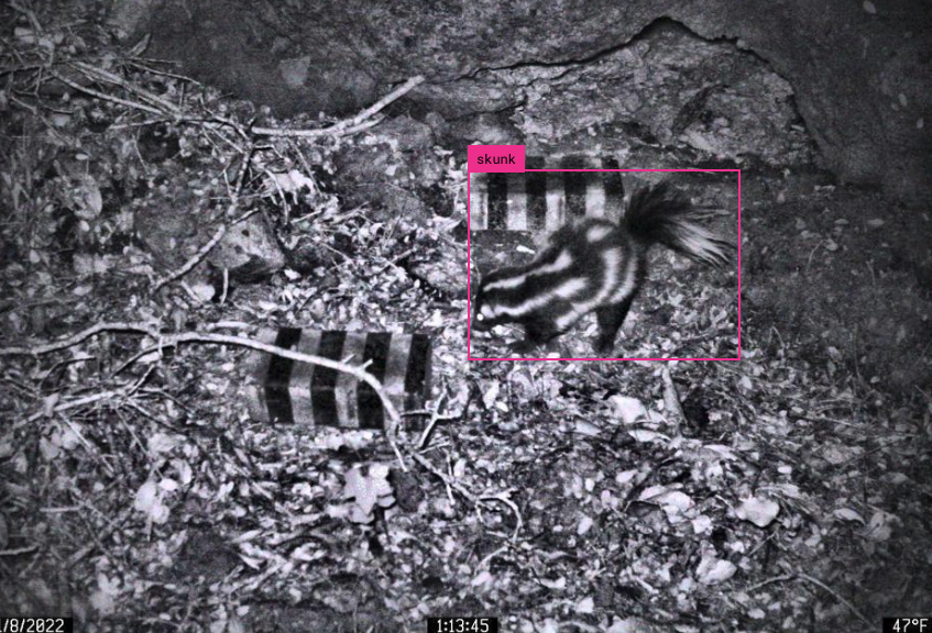
TNC's Work: TNC is using camera trap technologies and AI to monitor for, and prevent, harmful invasive species from establishing themselves on islands. Our work is beginning at our very own Santa Cruz Island Preserve, where we monitor for very specific uninvited guests: rats.
Until recently, it took months to get images from camera traps across Santa Cruz Island: field staff had to drive or hike rough terrain to retrieve the data cards, then upload and sift through thousands of images searching for rats. Now a network of camera traps across Santa Cruz Island is connected to the cloud, and a new software program we developed called Animl:
- centralizes and organizes thousands of images,
- applies machine learning to automatically identify what types of animals are in each image, and
- notifies staff via email or text if a particular type of animal is seen (this notification is critical for responding to an invasive species like a rat).
Now what used to take months takes mere minutes. Now we're aiming to implement similar technologies on other islands we need to protect.
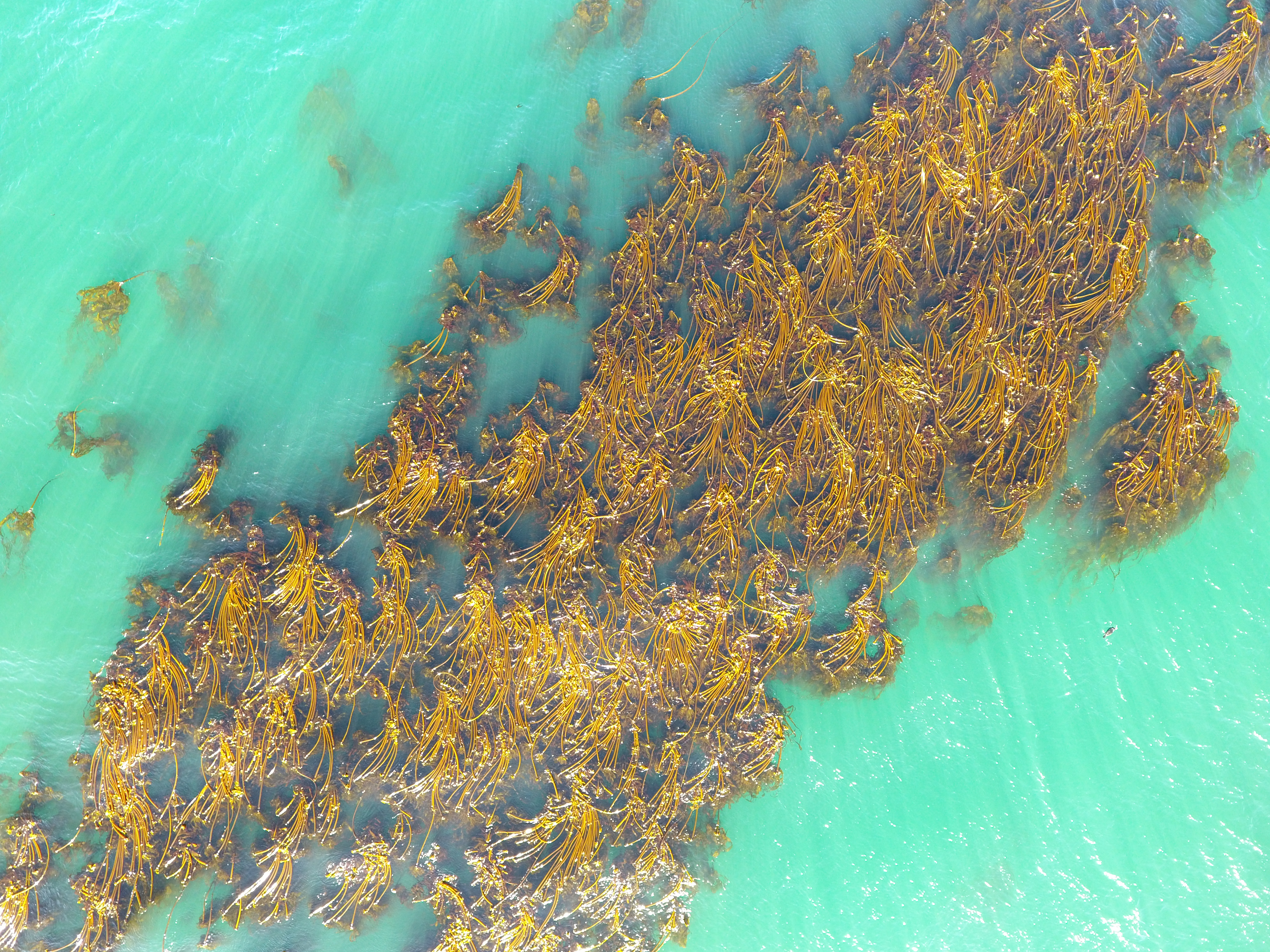
Monitoring Kelp Forests from Space
Kelp form the backbone of many productive and diverse ecosystems, providing habitat and food for thousands of species. But studies show that our kelp forests are diminishing due to increased threats driven by climate change, overfishing, and harvesting. On California’s North Coast, warming waters, the introduction of disease, and the loss of a key predator have led to a 93% reduction in bull kelp forests in less than a decade.
Unfortunately, our methods of tracking changes in kelp health have not kept pace with modern technology, and in order to protect and conserve these critical ecosystems, we must improve the way we map and monitor them.
To address this, TNC is investing in a cost-effective approach to mapping kelp abundance in near-real-time using satellite imagery and machine learning. We built a powerful visualization platform called KelpWatch that maps California's kelp strongholds. Ultimately, our plan is to replicate this method and publish data in other critical geographies around the world. Rebecca Flores Miller of the California Department of Fish and Wildlife says, “We are blown away by Kelp Watch; we can already see how it can be a really useful tool for managers.”
Check out the CNN kelp visualization using data from KelpWatch.

Using IoT Technology to Free Entangled Whales
Today, one of the leading human causes of whale mortality is accidental entanglement in fishing gear. When a report of an entangled whale comes in, trained responders try to locate that whale and cut it free of the gear. But they can't always do it in one try. Often, rescue crews attach a satellite tracking buoy to the gear so they can find the whale again and free it. But the current device needs an update, and that's where we come in.
Learn about ways we’re using technology to also reduce the risk of whale entanglements.
Addressing Urban Tree Cover Inequality
As climate change increases global temperatures, cities are at particular risk of extreme heat, especially areas with minimal tree cover. Urban heat islands (UHI) experience significantly higher temperatures and disproportionately impact disadvantaged communities. But urban tree planting can reduce UHI effects and support critical biodiversity.
A statewide study conducted by California ReLeaf in 2014 showed that urban reforestation in California has the potential to yield $1.1 billion in total benefits, sequester 4.5 million metric tons of CO2 annually, and reduce heat-related medical visits.
TNC and partners developed an algorithm that uses satellite imagery to map the areas where addressing inequality in tree cover between low-income and high-income neighborhoods would reduce UHI impacts while advancing environmental justice.
In a recently published paper, “Feasibility of afforestation as an equitable nature-based solution in urban areas,” we quantitatively assess the feasibility of tree planting to address urban tree inequity across 200 cities in California.
Quote: Matt Merrifield

TNC has an agile technology team that can rapidly evaluate and deploy the innovations that are remaking industries and economies. Our goal is to utilize these technologies to scale TNC’s conservation strategies.
Make a Difference
Nature isn’t far off in the mountains or the forest; it’s the air we breathe and the water we drink. The way we treat nature determines the way nature treats us, for better...or worse.
More from California
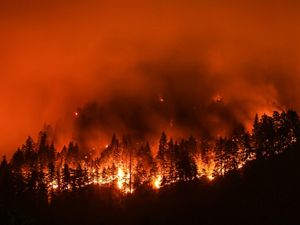
California: Let’s Stop Making Wildfire History
Fires in California continue to set new records for the “largest,” “most damaging,” “worst air quality” and “most costly” we’ve ever seen.
California Land Management
We're invested in making conservation business as usual so that we can change the trajectory of our planet. It's already working in California!
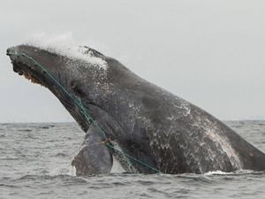
Making the Sea Safer for Whales
Collaborative efforts by TNC, fishermen, agency partners and scientists are helping reduce the risk of whales getting entangled in fishing gear off California’s coast.