Places We Protect

Davis Mountains Preserve

Texas

Rocky outcrops and mountains shoot up towards the sky behind a pine forest.
DAVIS MOUNTAINS PRESERVE One of only three sky islands in Texas. © Jerod Foster

A rugged yet fragile sky-island refuge, the Davis Mountains Preserve is surrounded by a vast, West Texas desert landscape.

Overview

Description

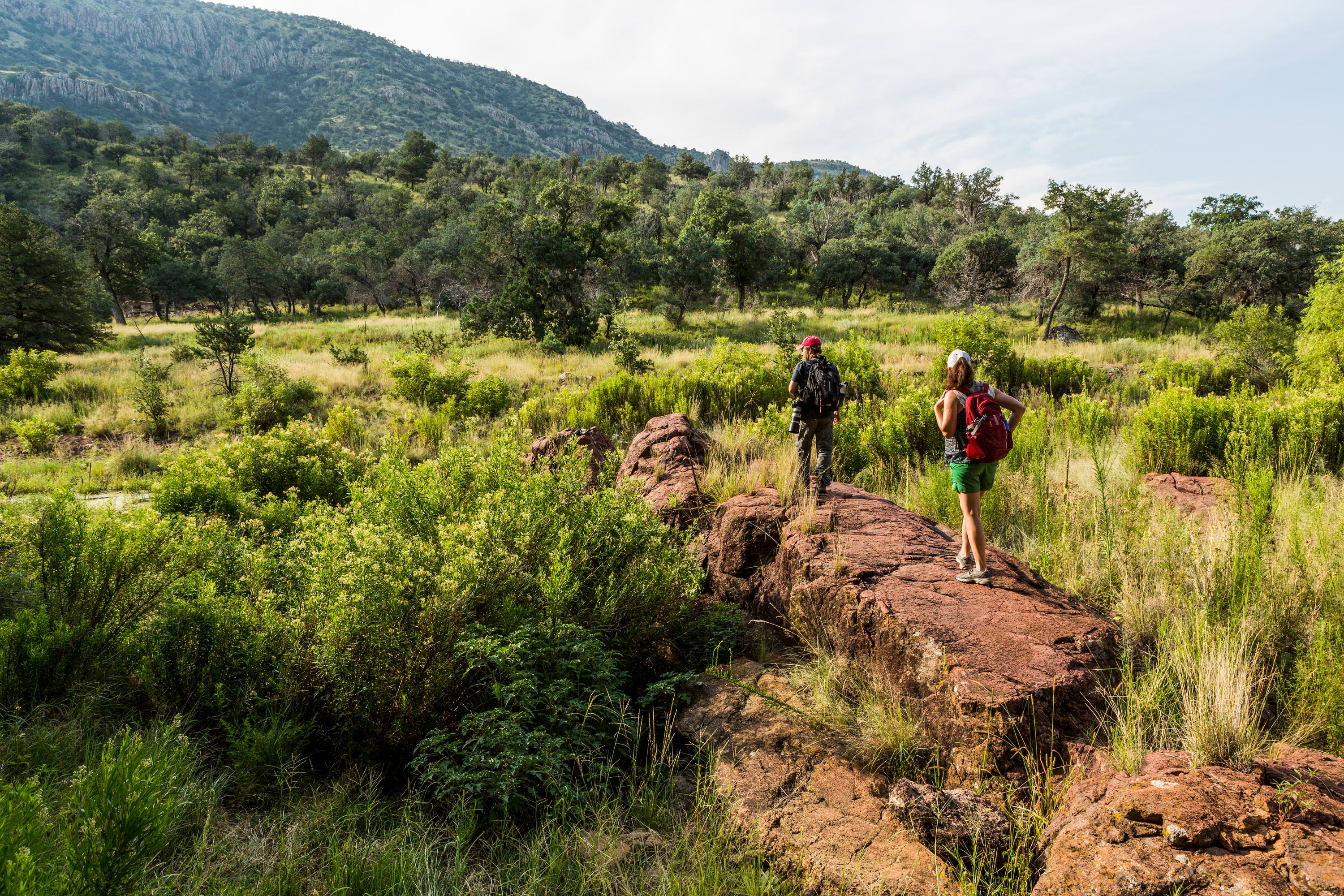
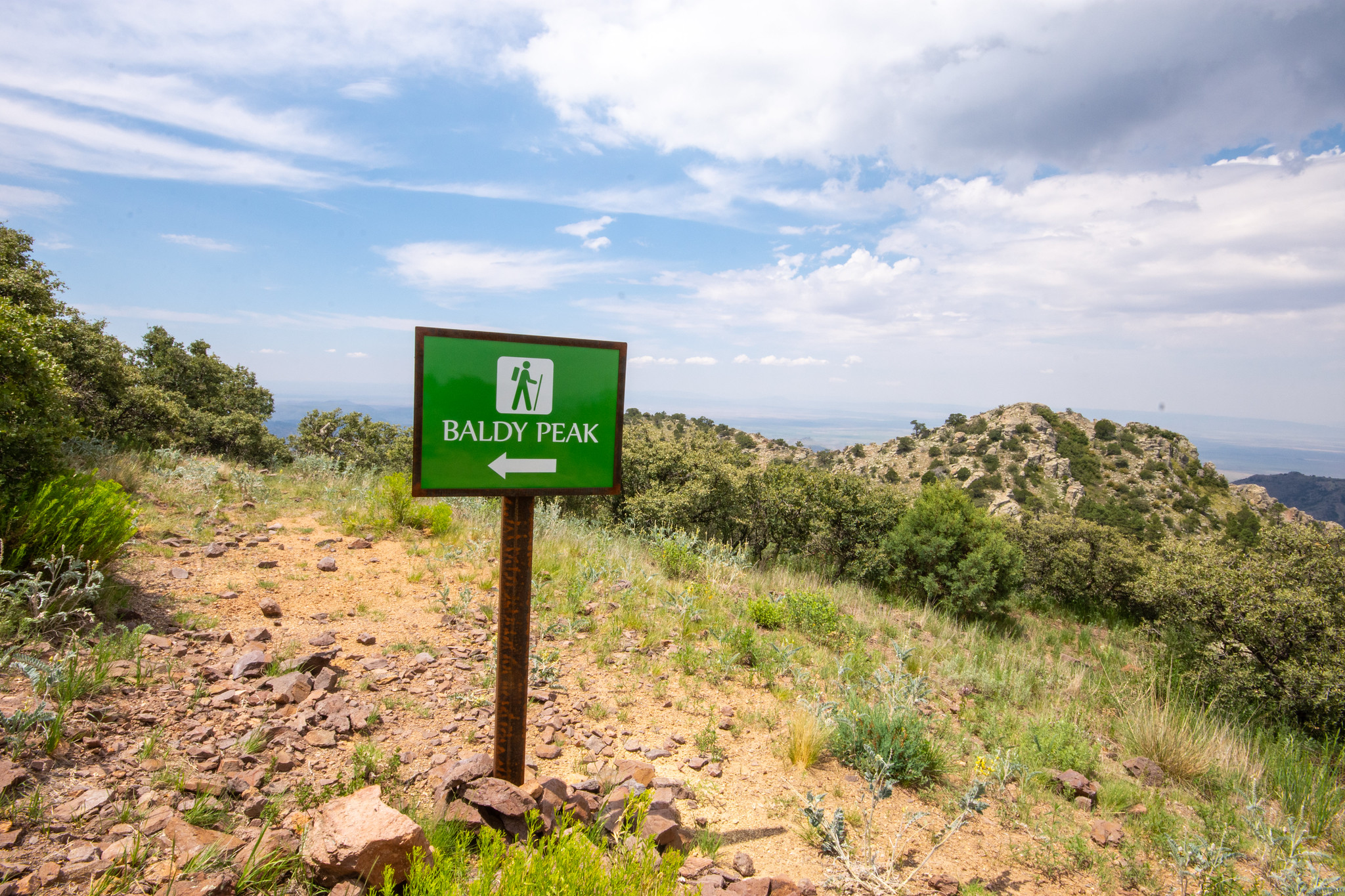
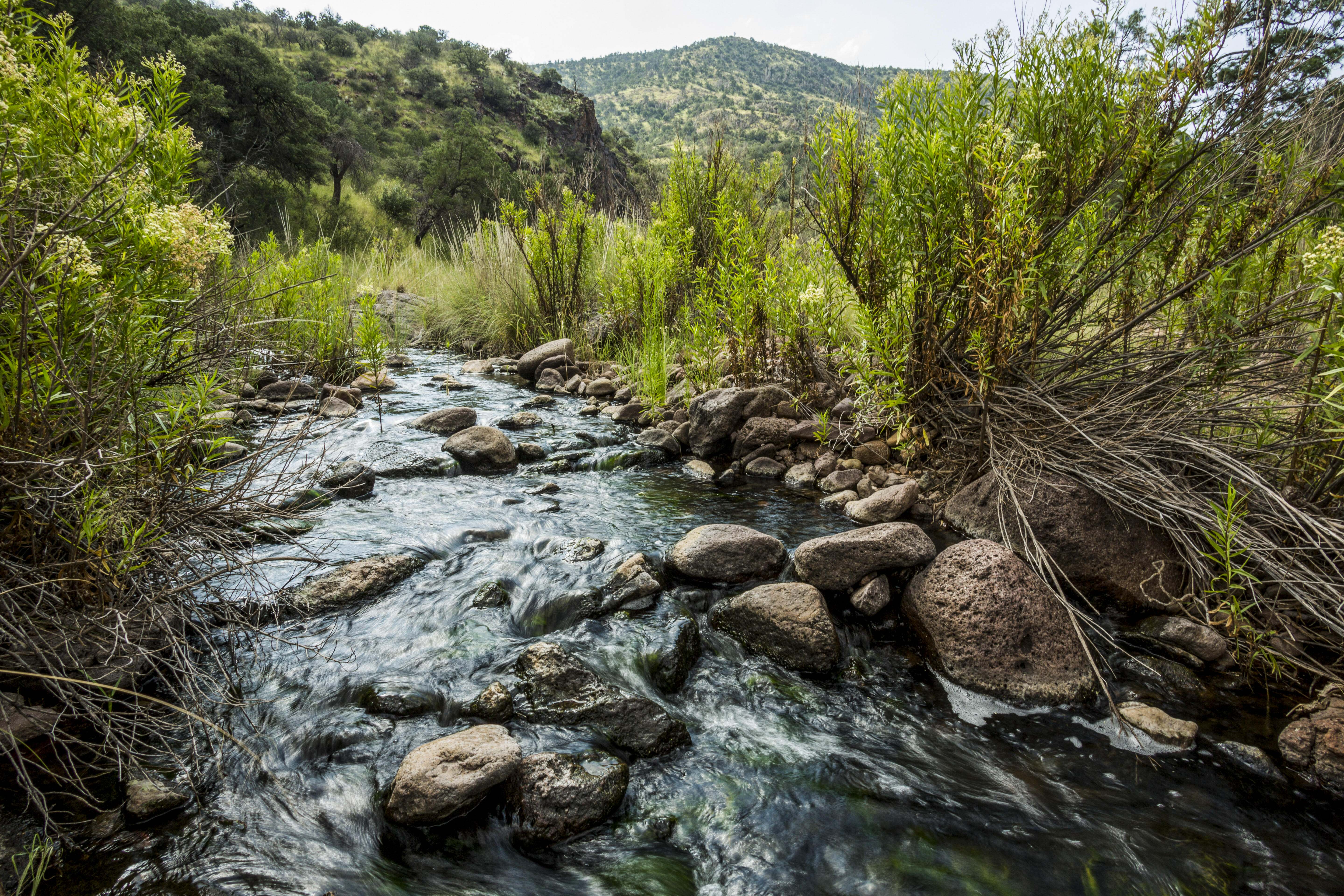
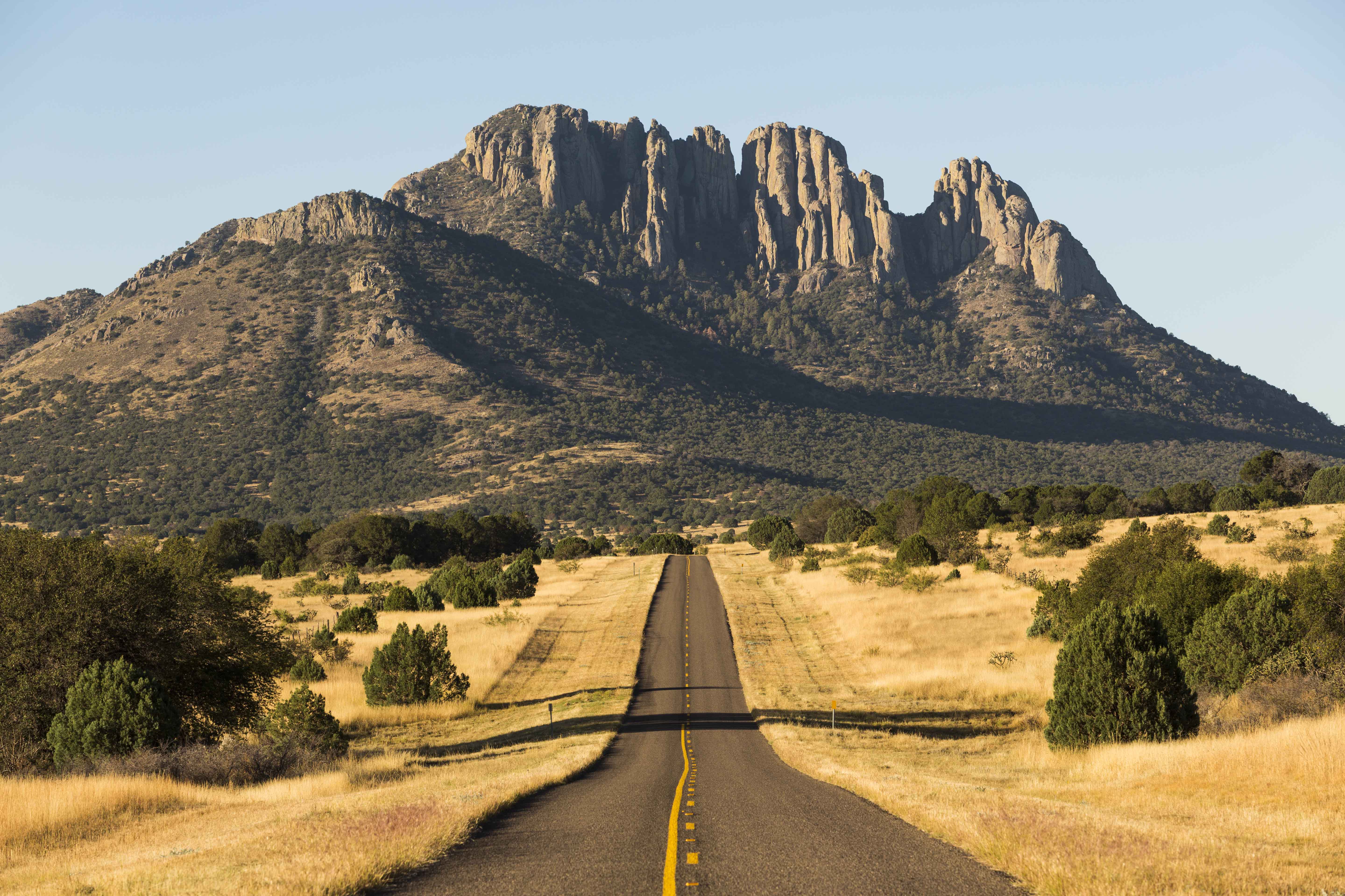
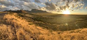
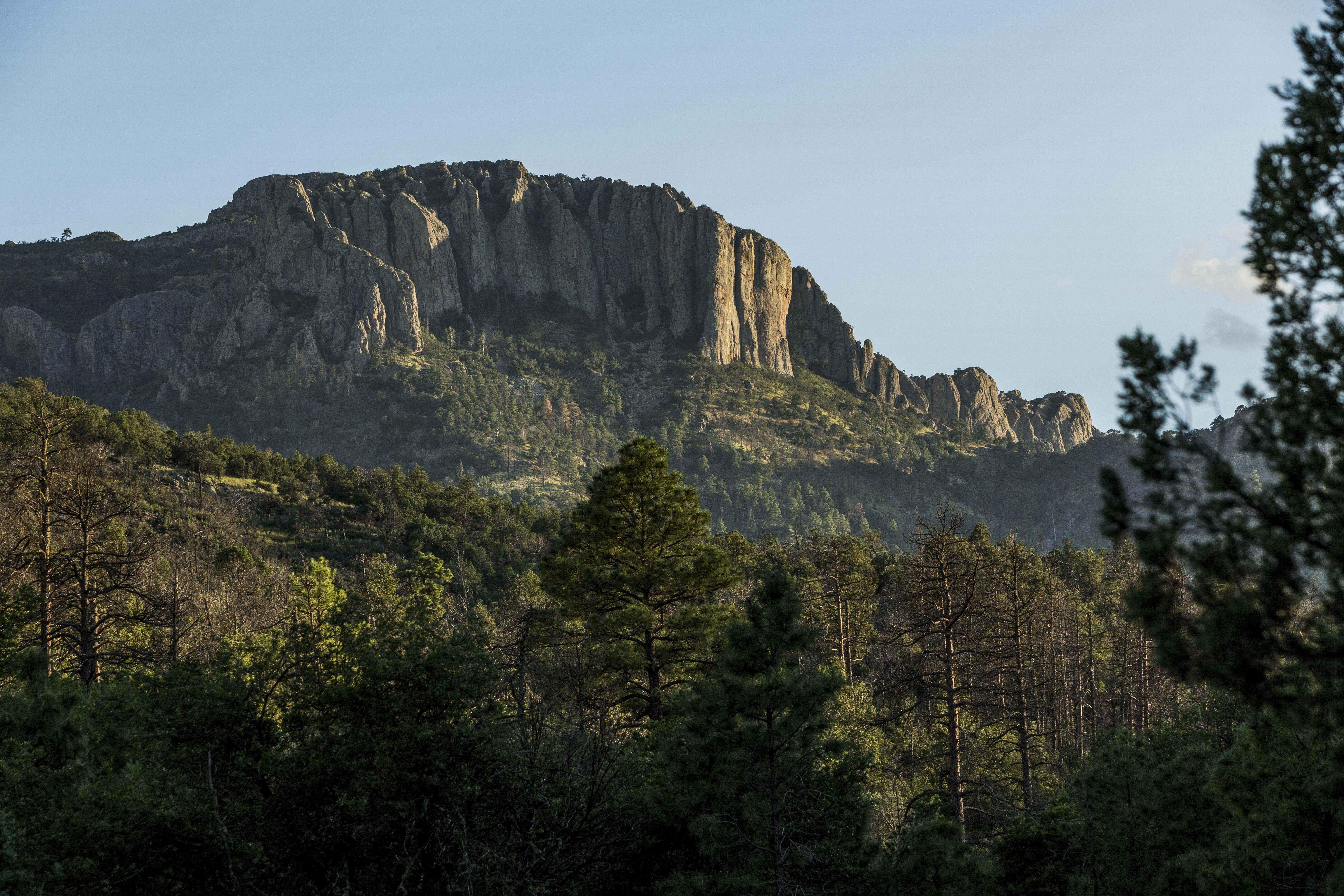
The wild and remote Davis Mountains are among Texas’ most awe-inspiring natural areas, evoking the rugged cowboy heritage of the Lone Star State. But wide, open spaces like these are becoming fewer and further between; Texas land is fragmenting faster than any other state, our population continues to climb and development is increasing its pace. With the Davis Mountains forming one of only three of the state’s unique sky islands—a cooler, wetter landscape surrounded by arid lowland desert—conserving this Texas treasure for people and wildlife is now more important than ever.

To help protect this unique ecosystem, The Nature Conservancy (TNC) established the 32,844-acre Davis Mountains Preserve. Subsequent land acquisitions combined with conservation easements on adjoining properties have allowed TNC to protect nearly 110,000 acres of the Davis Mountains region.

Access

Limited Access

See 'Visit' tab for details on access to the preserve and the Madera Canyon Trail.

Highlights

Hiking, birding, camping, equestrian, wildlife viewing

Size

32,844 acres

Explore our work in Texas

Operation Ponderosa

Operation Ponderosa (8:18) Ecologist & Science Project Director Charlotte Reemts explains how TNC, Texas A&M Forest Service and U.S. Forest Service are collaborating to thin Ponderosa pine trees at the Davis Mountains Preserve.
Two hikers walk on a rock outcropping.
UNIQUE HABITAT TNC's Davis Mountains Preserve protects habitat for rare, threatened and endangered species in Texas. © Jerod Foster

Why This Place Matters

Formed by volcanoes and sculpted by wind and water, the Davis Mountains rise more than 8,300 feet above sea level out of the expansive Chihuahuan Desert. While the Trans-Pecos, the area west of the Pecos River, is true desert habitat, the Davis Mountains are temperate and forested—an anomaly in an arid land. However, as Texas continues to grow and develop, the region’s natural resources are being stretched to their limits, impacting everything from biodiversity and habitat preservation to freshwater supplies.

The Davis Mountains Preserve is home to canyon watersheds that feed Little Aguja, Limpia, Madera and Cherry Creeks—water sources that support diverse wildlife and are crucial habitat for rare aquatic species. The sky island also contains plants and animals unable to survive in the harsh desert conditions below, offering refuge for sensitive species like the Rivoli’s hummingbird. Additionally, the preserve provides important wildlife corridors with minimal human presence, a requirement for large mammals such as black bears.

Large, intact landscapes also promote dark skies, critical to ongoing astronomical research at the nearby University of Texas McDonald Observatory. To further preserve this cherished natural feature, TNC and a number of partners worked together to establish the Greater Big Bend International Dark Sky Reserve in 2022—the world’s largest International Dark Sky Reserve—which includes the Davis Mountains Preserve. Ultimately, this effort will benefit biodiversity and tourism by keeping the stars at night big and bright for both people and nature.

Photos from Davis Mountains Preserve

Discover the diverse plant life and wildlife at this unique sky island in the heart of West Texas. Tag @nature_tx on Instagram with your photos when you visit.

A man sits on a rock and aims a camera at an object in front of him, while other people stand on rocks in the background.
A closeup of a horned lizard sitting on rocks with rough, brown scales.
A cabin sits on a grassy meadow against a backdrop of forested mountains.
A small owl with grey and white feathers and large glowing yellow eyes.
A trail sign reading Baldy Peak sits against a backdrop of sweeping mountains.
A stream flows down a rocky mountain side, lined with green trees and shrubs.
A bright full moon illuminates the night sky over West Texas.
A closeup of a hummingbird with beating wings.
A mountain range shoots up from surrounding desert on an empty road.
A person rides a brown horse across a grassy meadow as a second brown horse follows them at a trot.
A closeup of a pine seedling in a protective tube.
RESTORING THE LANDSCAPE TNC and partners are working to keep the preserve's population of Ponderosa pine trees healthy; this species of tree only grows at altitudes of 4,000 to 8,000 feet. © Kenny Braun

What TNC Is Doing

While the preserve itself encompasses nearly 33,000 acres, over the last two decades, TNC has protected just shy of 110,000 acres of the Davis Mountains area through land purchases, conservation easements and partnerships with local landowners. In close collaboration with government agencies, universities and other partners, we’re conducting research aimed at protecting the fragile species that call our preserve home, like the Ponderosa pine tree. Dedicated volunteers also work with staff to steward preserve land and water, engage the community and connect people to this iconic West Texas landscape.

Visit

  • TNC's Davis Mountains Preserve—home to Mount Livermore and Baldy Peak—is closed to the public for research and conservation-related management activities throughout the majority of the year. However, the preserve opens for camping, hiking, biking, equestrian, picnics, photography, birding and other outdoor activities on select weekends throughout the year. These dates are posted on the Davis Mountains Open Events Page, along with more detailed information about visiting the preserve.

    Begining in 2023, reservations will no longer be required to attend Open Events on the preserve, with the exception of occasional special events.

    Our Madera Canyon Trail is separate from the Davis Mountains Preserve and is open to the public all year long, from sunrise to sunset, regardless of the closure of the Davis Mountains Preserve.

  • If you’d like to receive the most up-to-date information about the Davis Mountains Preserve, including updates on our Open Events, please join our email list by contacting West Texas Education and Outreach Coordinator Kaylee French (kaylee.french@tnc.org), sign up for our TNC Texas Nature News or “Like” The Nature Conservancy in Texas on Facebook.

  • Drive, hike and bike through stunning landscapes that recall Texas’ rugged history and heritage. Towering Ponderosa pine trees shade cool mountain creeks, and at each turn, dramatic views of canyons and peaks delight visitors. Camp overnight to experience brilliant night skies beneath the largest Dark Sky Reserve in the world.

    Keep your eye out for black bears, bobcats, elk, mountain lions, Grace’s warblers, Mountain chickadees, mountain short-horned lizards, long-eared owls, painted redstarts, Zone-tailed hawks, golden eagles, Texas madrone trees, Mexican dwarf oaks and aspen groves on the trail to Baldy Peak.

  • The Davis Mountains Preserve is located approximately 25 miles northwest of Fort Davis on Highway 118N (about 10 miles past McDonald Observatory and about ¼ mile past the Lawrence E. Wood Picnic Area). Guests are required to sign in and out at the kiosk along the main preserve road.

    Directions from Fort Davis:

    Head north through town on Hwy 118 North (left) and continue for 24 miles. The road takes you up almost 1,000 feet and winds around the mountains and past the McDonald Observatory. Eight miles past the Observatory, turn left at the first entrance into the Lawrence E. Wood Picnic Area, and the trailhead is on your immediate left.

    Directions from Kent:

    Take Hwy 118 South for about 23 miles to the intersection of Hwy 118 and Hwy 166. Bear left to stay on Hwy 118 and continue on for about 6 miles, where you will bear right into the Lawrence E. Wood Picnic Area. The trailhead is at the far end.

  • View and download the Davis Mountains Preserve Trail Map.

    View and download the Madera Canyon Trail Map.