Description
Rob’s Trail Preserve is a collection of memorial trails nestled among the high ridges and rolling hills of the Finger Lakes.
Learn more about the wonders of Rob’s Trail via the tabs above.
Rob’s Trail Preserve is a collection of memorial trails nestled among the high ridges and rolling hills of the Finger Lakes.
Learn more about the wonders of Rob’s Trail via the tabs above.
OPEN TO THE PUBLIC
This 170-acre preserve is located in Livingston County, NY.
170 acres
Rob’s Trail Preserve is open year-round from dawn to dusk.
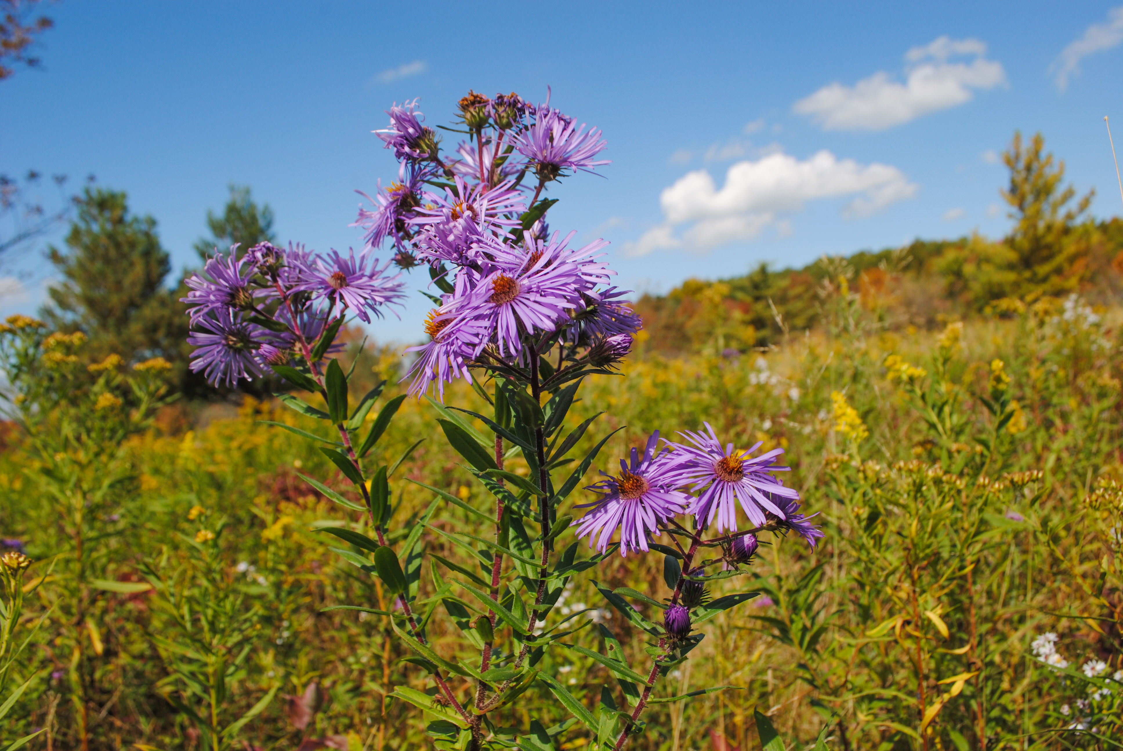
Animals: Bald eagles nest at the south end of Hemlock Lake and may be seen kettling overhead. In the successional woodland keep an eye out for migrating warblers, turkeys and ruffed grouse. Deer and weasels can also be spotted on occasion. Bees and butterflies harvest nectar from the abundant asters and goldenrods in the fall.
Plants: Rob’s Trail passes through several types of habitats, from old-field herbaceous plants to mature hardwood forest, a journey that mirrors the changes that will happen here over the next 100 years. Mature trees include white oak, sugar maple, and shagbark hickory. Clones of green ash form uniform stands. Goldenrod, buckthorn, native gray dogwood, turtlehead and closed gentian can also be found here.
Rob’s Trail Preserve is open during hunting season (Oct 1 – Dec 21, Dec 26 – Jan 1). Written permission is required to hunt on TNC lands. To learn more about our hunting program or to obtain permission to hunt, please visit our New York hunting information page.
The preserve features the following trails: Loop Trail (1.75 miles), Canadice Lake Trail (.75 miles), Hemlock Trail (4.8 miles; to shoreline is 1.5 miles, to boat launch is 4.8 miles), Connector Trail (.28 miles).
Be careful on the trails as they may be wet or uneven. Please be advised the spur trail to Canadice Lake is a challenging trail that is steep and minimally maintained.
Take a moment to review the trailhead kiosks, which describe the trails, the property’s import role in protecting drinking water and the geological forces that created the Finger Lakes. See our full preserve visitation guidelines for more information.
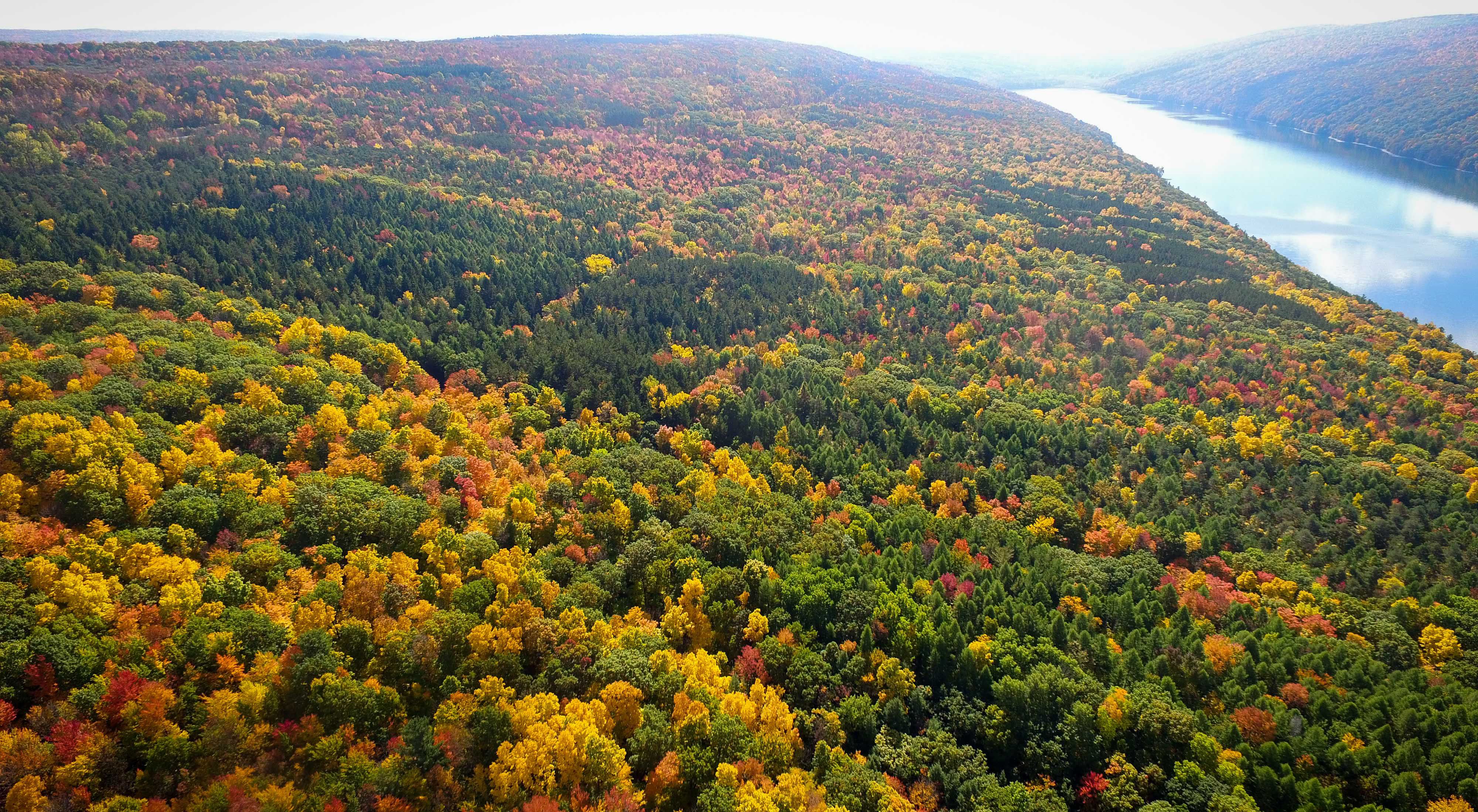
Completed in 2008, Rob’s Trail—Canadice was built to connect two undeveloped lakeshore properties that protect Hemlock and Canadice Lakes, the main source of Rochester’s drinking water supply. With the help of donors and volunteers, a new trail, Rob’s Trail—Hemlock Lake, was built in 2016 that makes it possible to hike from one lake to the other.
The Nature Conservancy in New York built these trails to honor the memory of Rob van der Stricht, our esteemed board chair who passed away in 2006. Rob was an avid birder, canoeist, and fisherman who carried a broad smile and a pair of binoculars everywhere he went. He was especially fond of the Finger Lakes, particularly Hemlock and Canadice. His commitment to preserving nature inspired us all, and The Nature Conservancy officially dedicated this trail to his memory.
Once a hardwood forest converted to cropland, Rob’s Trail showcases ecological communities, scenic vistas and geological features typical of the Finger Lakes Region.
Hemlock and Canadice are the only Finger Lakes with undeveloped shorelines. In the 1890s the City of Rochester began acquiring lakeshore properties to prevent the development of the watershed and to safeguard its primary source of drinking water.

The Nature Conservancy owns nearly 1,500 preserves covering more than 2.5 million acres across all 50 states. These lands protect wildlife and natural systems, serve as living laboratories for innovative science and connect people to the natural world.