2021 Geospatial Conservation Annual Report
How we’re using geospatial technology to find and address critical conservation gaps to meet our conservation goals for 2030.
Get the Geospatial Annual Report & Map Book
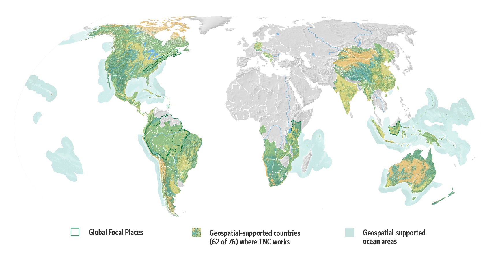
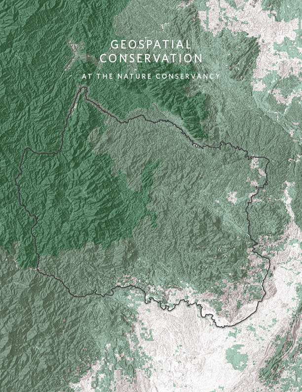
These maps illustrate the range in which geospatial technology is used in priority areas.
Get the Report NowPeople and nature are facing the biggest, most complex environmental and social challenges of our times. We have years, not decades, to take on the interconnected crises of climate change and biodiversity loss. Geospatial technology plays an integral role in confronting these challenges with urgency, community and equity, for the health of our planet and all people.
The Nature Conservancy has ambitious goals to reach by 2030. These goals, which will inform and guide our work in the coming years, are to:
- Remove or sequester 3 gigatons of CO2 each year
- Protect 4 billion hectares of ocean
- Protect 650 million hectares of land
- Protect 1 million kilometers of rivers
- Protect 30 million hectares of lakes and wetlands
- Benefit 100 million people
Our 2030 Goals
-

3 B
3 billion tons of carbon removed or sequestered each year
-

4 B
4 billion hectares of ocean conserved
-

650 M
650 million hectares of land conserved
-

30 M
30 million hectares of lakes and wetlands conserved
The Geospatial Annual Report & Map Book provides a snapshot of TNC’s geospatial conservation science work in four key geographies: the U.S. Appalachians, Kalimantan in Indonesia, the Brazilian Amazon, and Kenya. In each of these geographies, we use geospatial science to find and address critical conservation gaps and track progress.
Quote: David Banks
We are harnessing best-in-class cloud & data technologies to advance the oldest of technologies—nature—to solve today's most pressing challenges.
With data visualization, we create compelling conservation stories to communicate the relationship between current and desired conditions.
Focal Applications
Maps are central to our mission, leveraging ecosystem, climate and human activity data as decision support. The four geographies in this map highlight applications of geospatial technology supporting conservation to measure our conservation gains by 2030.
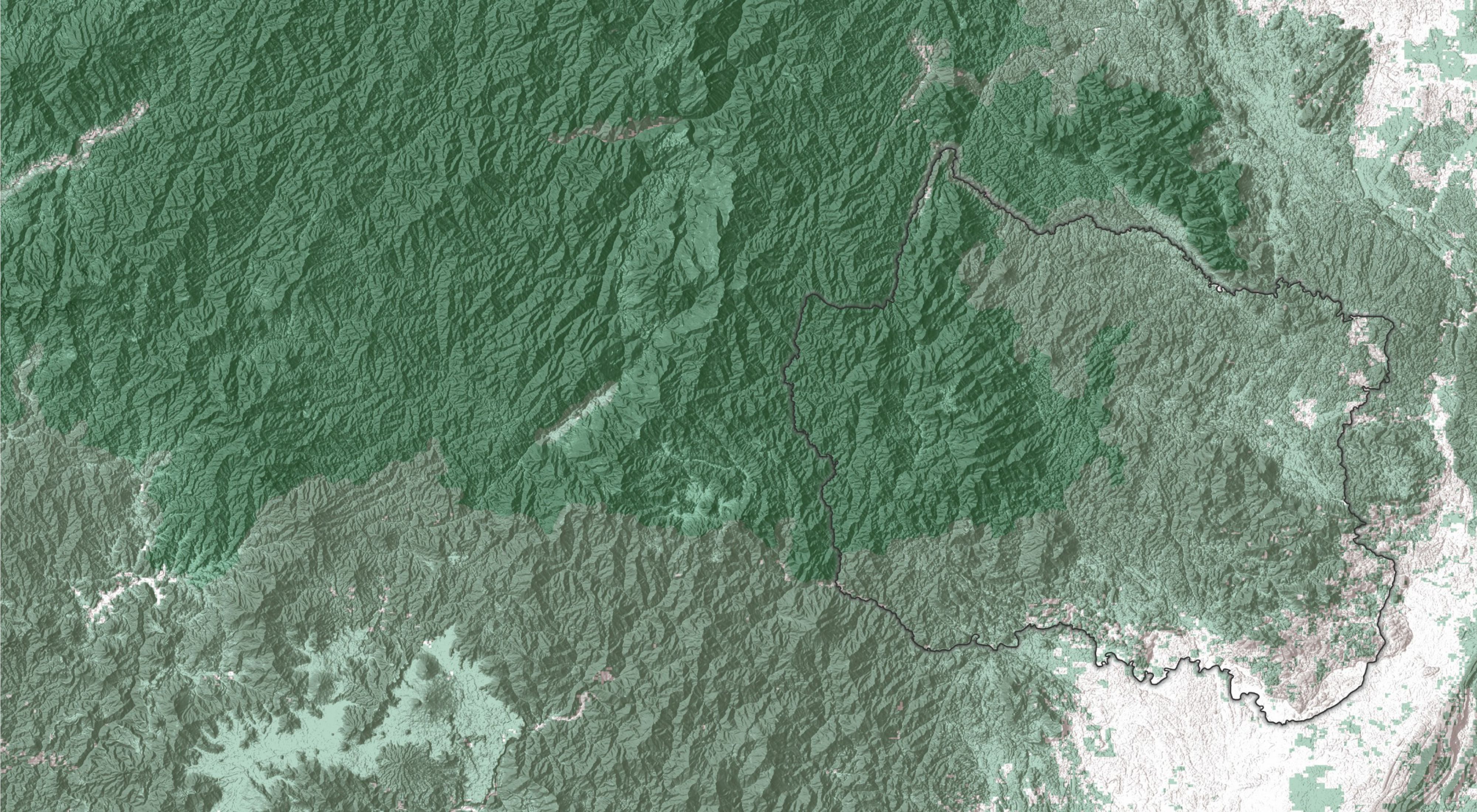
Appalachians
The Appalachians are a safe harbor for people and wildlife facing the impacts of climate change. Geospatial science methodologies have identified lands resilient to climate change, creating a roadmap for preserving lands in the Appalachians and priority resilient landscapes around the globe.
Amazon
The Pará State in Brazil is one of the most threatened regions in the Amazon, and is home to Indigenous communities with deep connections to the ecosystem. Geospatial data and analysis helps identify the conservation potential of ecosystems while prioritizing areas in critical need of action.
Kenya
Kenya seeks to maintain its legacy of community conservation by balancing bidoversity loss reductions and maintaining ecosystem processes with sustainable resource use. Geospatial tools have advanced local knowledge on wildlife land use areas and helped identify areas that can be protected to benefit wildlife and people.
Borneo
Indonesia's goal is to balance sustainable economic growth and poverty reduction with natural resource protection. TNC is working to protect mangrove forests through sustainable fishing and aquaculture knowledge sharing. Province-wide, spatial land use data targets key places to protect.
Focal application: Kalimantan, Indonesia (Borneo)
Kalimantan, the Indonesian part of the island of Borneo, represents 1% of the world’s land. Despite this tiny footprint, it’s home to over 6% of the world’s terrestrial and freshwater biodiversity. Its tropical marine ecosystem is one of the richest and most diverse in the world, housing 23% of all mangroves.


Yayasan Konservasi Alam Nusantara (YKAN), TNC’s affiliate in Indonesia, works in the Kalimantan region. YKAN engages a local coalition of communities, companies and governments in their climate goal of absorbing 1.4 gigatons of CO2e from the atmosphere, storing it in forests and wetlands. Natural climate solutions can get them 40% of the way there through avoiding forest and peatland conversion, improving fisheries, and encouraging community-centered approaches to sustainable forest management.

Challenge: Balance economic growth with natural resource protection
Deforestation is a part of Indonesia’s past and present, making the country a top contributor to carbon emissions but also helping reduce poverty in local communities. Indonesia is on a mission to balance sustainable economic growth and poverty reduction with natural resource protection.
Protecting High Conservation Value (HCV) forests is critical to Indonesia’s goal, yet only 20% of these forests are protected. In marine ecosystems, less than 7% of remaining mangrove forests are protected. Shrimp farms, driven by global demand, have replaced many mangrove forests. However, intensive shrimp production in previously forested areas has led to a decline in shrimp farm productivity. Farmers are seeing less than ¼ of their usual yields. As farmers look for ways to make up for the declining yields, remaining mangroves are at increased risk.
Solution: Map HCV areas to improve livelihoods and build on past success
Geospatial analysis has helped identify conservation actions that can protect mangroves near existing shrimp farms. Using remotely sensed imagery, YKAN maps the status of current land cover types, models habitat areas for sensitive species, and identifies conflicts with development. Province-wide, spatial land use data targets key places to protect so we can chip away at these ambitious ecological and community goals.
More case studies from around the world
Our work in 4 priority geographies illustrate our global geospatial conservation work.
Download Your CopyYKAN builds on previous successes in this area. Collaborative landscape management in the Wehea-Kelay Orangutan habitat spurred a decision to identify twelve more HCV areas. These areas will be managed for endangered species, karst, mangroves, and critical ecosystem services.
This work compliments the HCV conservation goals to reduce shrimp aquaculture expansion into mangrove forests and restore converted areas. TNC is working to protect the second largest intact mangrove forest in the East Kalimantan Province through sustainable fishing and aquaculture knowledge sharing.

Several projects will be used as a model to inform mangrove protection and restoration in Kalimantan:
- Use rare, threatened and endemic/native mangrove species for restoration.
- Implement national policy that guides greenhouse gas mitigation through an aquaculture improvement plan.
- Establish a government taskforce for mangrove management.
By 2030, YKAN’s goal is to improve forest management for 15.7 million hectares, avoid deforestation across 1.5 million hectares, and protect 1.75 million hectares of land. These conservation actions will improve shrimp farm productivity and restore mangrove forests, providing economic and ecological benefits.


Looking ahead
We need to have a better understanding of where we’re working to achieve results in meeting our ambitious 2030 goals. Like the story from Indonesia's Kalimantan region, other focal applications in the report highlight how geospatial data are being leveraged to calculate our progress in achieving our 2030 organizational goals. A more comprehensive foundation of spatial data can help us get there by introducing additional transparency and efficiency in reporting on our conservation progress.
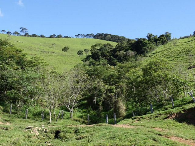
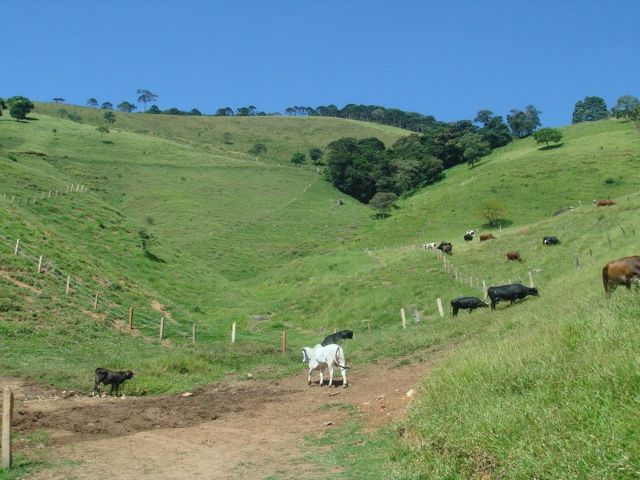
In another case study in Brazil’s Mantiqueria mountains, landowners are compensated for converting pasture lands through restoration. Calculating acres of restored forest land is helping TNC build a scalable geospatial reporting system that can be integrated with the organization's financial-based accounting system. A future outcome of this work will be a dynamic “where we work” map, with the purpose of more effectively communicating and tracking our progress.
Thanks to our advanced collaborations principally with Esri, Amazon Web Services, and Microsoft, we are able to address the needs of our conservation community with appropriate, timely, and innovative technology. TNC is harnessing the power of data and cloud technology to build geospatial science solutions that measure the success of our conservation efforts and align with our 2030 goals.
Quote: Johanna M. Ward
The spatially explicit conservation stories in this annual report support the integral role of geospatial technology as we set our sights on accomplishing these lofty ambitions for the health of our planet and all people.
Download the report and visit our Geospatial Conservation Atlas for more information. The full 2021 Geospatial Annual Report & Map Book includes:
- Four key geographics for achieving our 2030 goals: the U.S. Appalachians, Kalimantan in Indonesia, the Brazilian Amazon, and Kenya.
- A first global analysis that summarizes development threats to Indigenous lands and opportunities for conservation actors to respond.
- A global spatial analysis on the warming impact of methane emissions.
- A look to future work in conservation accounting and geospatial reporting in tracking our goals.
- Results from our annual survey that reached over 1,500 staff.
- Maps that follow our emerging cartographic guidelines to define our "conservation map brand".
Download
The maps and use cases illustrate the range with which geospatial technology is used among four priority geographies around the world.
DOWNLOAD Geospatial Atlas
Media Contact
Zach Ferdaña
Director, Conservation & Geospatial Systems
The Nature Conservancy
Phone: 206-409-0041
Email: zferdana@tnc.org
