interstitialRedirectModalTitle

interstitialRedirectModalMessage

Stories in New Mexico

Wetland Jewels: The La Jara Restoration Project

Landscape view of a narrow stream winding through a grassy wetland with a forest in the background.

The Rio Fernando flows through the heart of Taos serving as a primary water source for produce, plants and wells. Migrating birds soar over the stream during spring and fall migrations, and the area provides forage for locals like the Northern goshawk and the American dipper. People who live here rely on the waterway to connect with nature whether you camp, canoe, hike or simply find peace when listening to the rippling water.

Map of the project areas of the La Jara Restoration project.

Using Nature to Improve Wetlands in the Face of Climate Change

To ensure we can maintain these values, The Nature Conservancy and partners are using nature-based solutions—including rocks and dirt—to improve the wetlands surrounding the waterway. This collaborative effort also includes an educational and community engagement component.

The work began when Amigos Bravos identified a number of critically important wetlands—Wetland Jewels—to bring attention to their value and secure their long-term protection and restoration. This work protects people and nature in the face of a warmer, drier climate.

The La Jara wetlands are located in the headwaters, or river source, of the Rio Fernando de Taos. Snowmelt and heavy rains feed the wetlands here before the water moves down the canyon and into the community of Taos.

By preserving and restoring the wetlands along the Rio Fernando, the soil and native plants act as natural filters for pollutants, which helps improve water quality. They also impact water quantity, because water absorbed upstream by these wetlands is released slowly, helping downstream plants, wildlife and waterways, especially late in the summer when precipitation levels are low.

Beneficial Partnerships

The river and surrounding vegetation supports cattle ranching as well, which is part of our region’s cultural identity and economy. By utilizing pasture fencing and working with community grazers, this project increases forage and provides water access to the herds while protecting sensitive river areas.
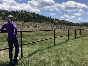
A person stands next to a simple two-run metal fence that stretches across a field.
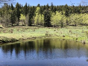
View of a large body of water in a wetland surrounded by forest.
Landscape view of a stream with many rocks in it meandering through a forest and green landscape.
Nature-Based Solutions

Hold It High and Slow It Down

Healthy streams are wide and shallow. A higher width-to-depth ratio decreases the speed, power and stress of moving water against the waterway’s banks. It reduces erosion and increases sediment buildup. Helping streams maintain width also encourages the natural turns and bends of a river.

In this project, the most important outcomes were reconnecting the floodplain and improving the health of the river.

A floodplain is the interactive area between a river and the adjacent land. A connected, healthy floodplain and surrounding wetlands help reduce flooding during heavy rains by absorbing extra water. They also keep the area wetter during dry periods, which helps stop the spread of wildfires and accelerates regrowth after fires.

Reducing channels dug out by fast-moving water helps reconnect a waterway to its natural floodplain, which supports a functioning river.

Illustration of a river with rocks and earthen structures that help the flow of the water.

We Can't Save Nature Without You

Sign up to receive monthly conservation news and updates from New Mexico.

Please provide a valid email address

You’ve already signed up with this email address. To review your email preferences, please visit nature.org/emailpreferences You’ve already signed up with this email address. To review your email preferences, please visit nature.org/emailpreferences

We may have detected a typo. Please enter a valid email address (formatted as name@company.com). Did you mean to type ?

We are sorry, but there was a problem processing the reCAPTCHA response. Please contact us at webmaster@tnc.org or try again later.

Simple Structures, Complex Benefits

You can see repair techniques along the riverscape here, including one-rock dams and earthen plugs. They help slow water down and spread it out, so it can be absorbed into the ground for use during the hotter and drier months.

One rock dams are a single layer of rock in the bed of the river channel. They stabilize the riverbed by slowing the flow of water, encourage vegetation growth and capture sediment, which raises the bottom.

Earthen plugs are a critical part of the restoration strategy. These small, low walls in the river prevent water from rushing downstream and instead spread it out across the wetland meadow. Plugs protect vulnerable streambanks and prevent further erosion.

Illustration of a river and camping sites adjacent to wetland restoration project areas.

Bringing the Rio Fernando Back to Life

Advocating for urgent stewardship of our world's precious freshwater, The Rio Fernando de Taos Revitalization Collaborative, with members including The Nature Conservancy and Amigos Bravos, are working on nature-based solutions that support resilience. 

Here, the Rio Fernando is essential to the vitality of Taos and supports areas well beyond. Starting at the top of La Jara Canyon and running through Cañon, the Fernando slowly makes its way through town, eventually joining the Rio Pueblo and Rio Grande.

Like many rivers and wetland areas in New Mexico, the Rio Fernando de Taos has been degraded due to fire suppression, historic overgrazing, road development and a warming and drying climate. Thank you for helping us care for this place by respecting the guidance below.

Best Practices for Recreational Land Use

Brown icon of a tent.

Camping Responsibly

Wetland restoration required enhancing the stream corridor. Please do not camp within 50 feet of the riverbank.

  • Creating new campsites kills vegetation and leads to soil erosion.
  • Do any washing at least 200 feet from rivers, streams, lakes or wetlands.
  • Visitors must park more than 100 feet from the riverbank and wetlands, as vehicle traffic can compact soil and can crush or break new plantings.
  • Leave No Trace—Hike/carry out all trash and pet waste. Leave the area in its natural state.
  • Cutting down or removing even small trees from this area is prohibited.
Green icon of a forest of trees.

Respect Trees of All Sizes

Trees big and small have a big impact in this restoration project. Smaller trees and saplings are planted along the banks to help improve the riverways. Cutting them down destabilizes new work underway. Carving or chopping into the trunks of larger trees can damage the tree and deprive the tree of nutrients and food, slowly starving it to death.

Red icon of a campfire.

Campfire Safety

Keep your campfire small. Use local wood: firewood brought from another area could also bring invasive pests that could harm local trees. If collecting firewood for your campsite is absolutely necessary, collect dead and down wood only.

Never leave a campfire unattended, even for a few minutes. Many wildfires start from abandoned fires expected to burn out or because someone thought a fire was already out. Do not bury your fire, as the coals can smolder and re-ignite. Stir the remains, add water and dirt, and stir again.

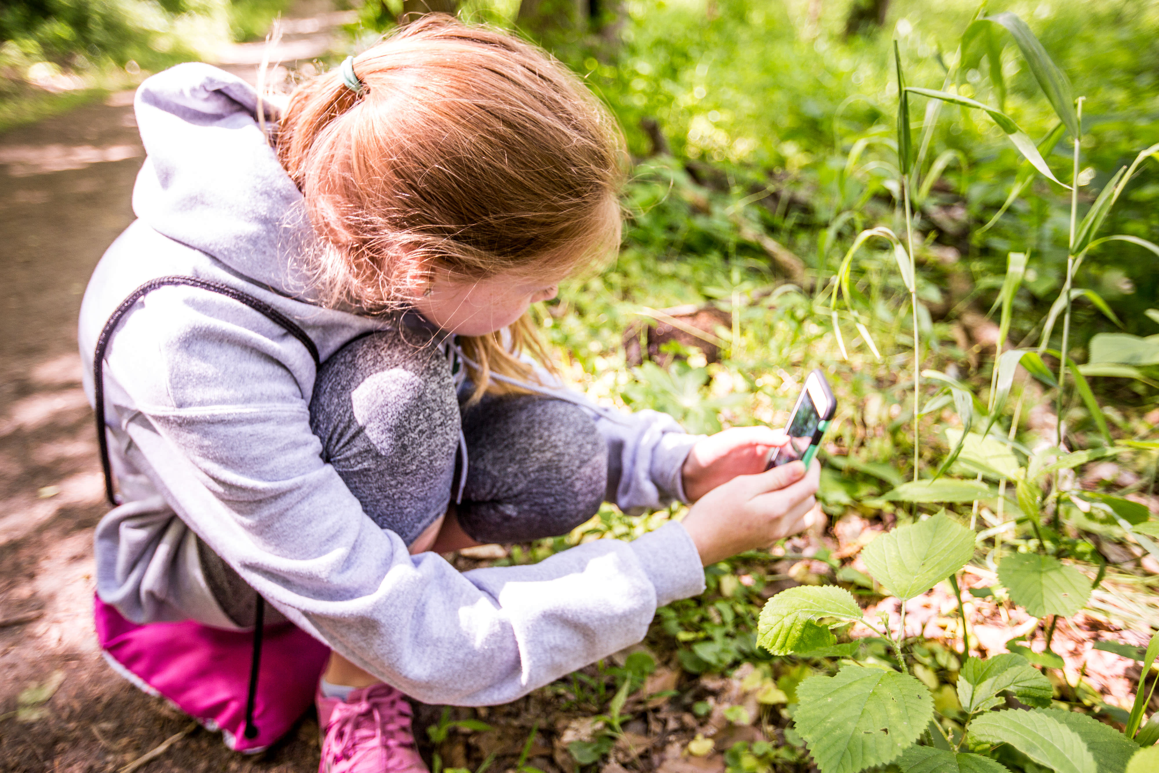
A girl crouches down and uses a smartphone to take a photo of a plant.

Citizen Scientists: Your Vision Makes a Difference

We’d like to ask you to help us track the improvements to ensure the restoration is working. Your photos can help us view the transformation over time.

Citizen scientists help monitor this project’s progress by taking photographs using a Picture Post, then uploading images from their visit to the La Jara Wetland Monitoring Project on iNaturalist.

Local researchers and foresters use this photo data to monitor the river, track progress and make improvement plans for the year ahead.

Learn more about using a Picture Post to take your photographs.