Connecting Lands for Climate Resilience
TNC data shows which landscapes will support plants and animals as the climate changes. We're working to protect those places.
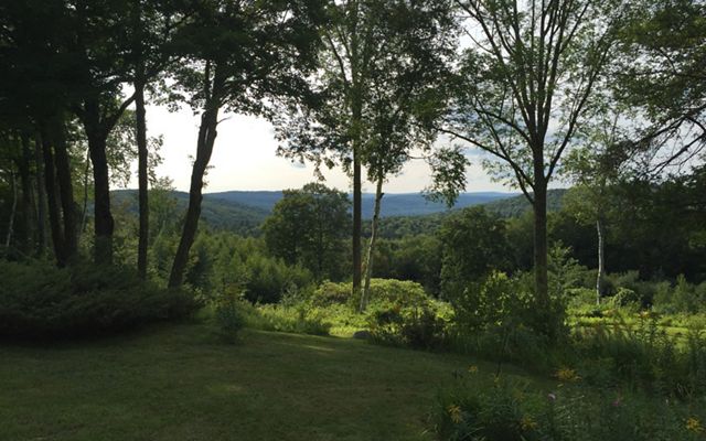
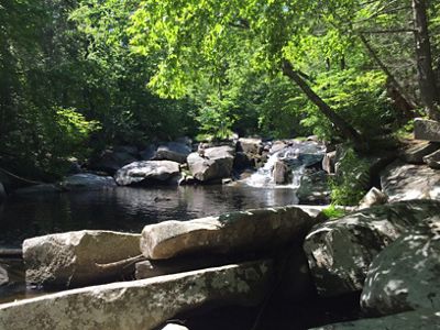
It’s lush and green in the summer, with the sounds of trickling water and rustling leaves. In winter, it’s a quietly pristine landscape with animal tracks visible in the fresh snow. This is The Nature Conservancy’s Dead Branch Preserve in Chesterfield, Massachusetts, a critical connector in a regional corridor of climate-resilient lands in the Northeast.
Growing the Scope of Land Protection
Conserving the Appalachians
Learn about our landscape-scale workThe intact forest in the Dead Branch Preserve plays an important role within the continental-scale Appalachian Ridge—it is one piece of a network of habitat that provides species with highways and neighborhoods for roaming and surviving. These lands have varied elevations, moisture levels and temperatures. This creates diverse microclimates that support species as they adapt to climate change’s effects on temperature, precipitation and habitat.


In 2019, TNC purchased 150 acres of land to add to Dead Branch Preserve and is on track to conserve additional parcels nearby, all of which are owned by the St. John family. The goal is to protect their more than 400 acres that support diverse and abundant wildlife and plants. The St. John land is the centerpiece of a nearly 9,000-acre matrix of protected forest lands around Dead Branch Brook, conserved together with federal, state and land trust partners.
Stitching Together Resilient Lands
“If we lose the connecting network of forests in Massachusetts to development, there is no safe path for wildlife to travel north to resilient habitat in Maine, New Hampshire and Vermont,” says Markelle Smith, landscape partnership manager for TNC in Massachusetts.
Resilient & Connected Landscapes Story Map
See how the Resilient & Connected Landscapes mapping tool identifies sites near you.
Explore the Story MapTo guide conservation in places like these, TNC recently completed a Resilient and Connected Network (RCN) map for the entire continental United States. The analysis, developed over the past 10 years by a team of TNC scientists based in Boston, highlights lands that will best sustain native plants, animals and natural processes into the future, assigning resilience scores based on the lands’ characteristics and connectedness.
“Based on these data, we can prioritize specific places for protection,” says Andy Finton, landscape conservation director in Massachusetts. “We identified the St. John land as having diverse microhabitats and outstanding connection to the surrounding landscape.”
Sharing and Scaling Our Science with Partners
Conserving lands at a continental scale is not the work of just one organization—we need institutional connectivity in addition to habitat connectivity. TNC is working with land trust and agency partners to incorporate the RCN data into their land protection and funding priorities by providing resources and technical support. TNC in Massachusetts has been at the forefront of this initiative, having collaborated with thousands of partners in Massachusetts and beyond to apply the data.

In this region of western Massachusetts, one landscape that brings multiple organizations together is the Silvio O. Conte National Fish and Wildlife Refuge, of which TNC’s Dead Branch Preserve is a part. The refuge is an important habitat corridor that stretches the length of the Connecticut River Watershed, from its headwaters at the New Hampshire–Canada border, south through Vermont and Massachusetts, to its estuary in the Long Island Sound.
Priority protection areas for the Conte Refuge include some of the most resilient lands in southern New England. Going forward, the RCN analysis will help both TNC and the U.S. Fish and Wildlife Service, as well as numerous conservation partners in the watershed, identify which lands are conservation priorities.
Supporting People, Plants and Animals
For the Hilltown Land Trust, one of the many organizations that protects land in the Massachusetts portion of the Conte Refuge, having access to the RCN data has been critical in guiding conservation efforts. In addition to applying the data toward land acquisition considerations, they have integrated it into their area’s Municipal Vulnerability Preparedness (MVP) program action plans.
The statewide MVP program—with which TNC has been involved for many years— helps towns proactively identify their vulnerabilities in the face of climate change and take action to build resilience. Natural solutions, like land conservation, can be an important strategy.
“Resilient lands not only benefit plants and animals—they ensure clean air and water, protect communities from extreme storms and flooding, and provide open green spaces for nearby communities,” says Smith. “This kind of access to nature boosts human health and well-being, an ever-more important resource in light of the global pandemic.”
In addition, protecting forests and wetlands keeps carbon stored in plants and soils, which continue to draw carbon out of the atmosphere over time and help minimize one of the root causes of climate change. Resilient lands are key to a future where people and nature thrive.


