Monitoring Our Progress
A six-year, $4.36 million study funded by the Natural Resources Conservation Service (NRCS) monitored the wildlife benefits and water-quality effects of wetland restoration in western Kentucky and western Tennessee. Launched in June 2018, the study was led by the NRCS and TNC. Murray State University, Tennessee Tech University, Middle Tennessee State University and the University of Missouri implemented the monitoring work.
“We work with farmers to take frequently flooded land out of agricultural production, plant native trees in the area, and where possible, restore the hydrology,” says Shelly Morris, director of freshwater conservation for TNC in Kentucky and Tennessee. “In some cases, we plug ditches that were installed decades ago to drain the land or install levees to retain water seasonally. After all this work, we want to know the impact we’re having on reducing nutrient pollution.”

According to Morris, an intact floodplain holds water after a flood event and slowly lets it drain back to the river. Many wetlands within the Mississippi River floodplain, however, have been ditched and cleared to allow for farming and development. As a result, water quickly runs off the land, taking excess nitrogen, phosphorus, and sediments into the river. This nutrient pollution makes its way down the river all the way to the Gulf, where it contributes to a dead zone—a low oxygen zone nearly devoid of life—that, in 2022 was reduced in size, but is still the size of Delaware and Rhode Island combined.
Healthy Floodplains Reduce Pollution
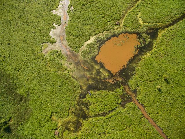
Conservation organizations have worked for years to restore wetlands so the land can hold water longer, reducing the nutrient pollution going into the Mississippi River.
The monitoring project studied the restored wetlands’ potential to reduce nutrient pollution and measured water and soil quality. Partner universities also looked at the wildlife impacts of these restoration efforts. Clarifying the effects of restoration will help conservation groups conduct better restoration in the future and may help secure funding for future projects.
Quote: Shelly Morris
What we’re really trying to accomplish here is a broader body of scientific knowledge and on-the-ground implementation across the entire Mississippi Basin. This project will soon be driving changes in how we approach restoration.
Conducting Research


Discoveries Made
From the onset of this project, teams were set up to focus on particular areas of research. Some researchers focused on learning how well wetlands can store nutrients such as nitrogen and phosphorus, while others focused on the wildlife benefits of restored wetlands. After bringing together the NRCS, TNC and dozens of researchers from regional universities, we looked at the discoveries made from our six-year monitoring project in western Kentucky and western Tennessee's Mississippi River Basin.
Professor Justin Murdock of Tennessee Tech University and his graduate research students pulled thousands of soil samples from wetland restoration sites, then brought them back to a lab to study how the soils filtered water under flood conditions. Meanwhile, Professor Michael Flinn of Murray State University conducted studies on the wetland region's entire biotic community, from insects to amphibians to birds.

If wetlands can capture nutrients like nitrogen and phosphorus and filter them out of the water before these pollutants enter the Mississippi River, that means better water quality both here and downstream. A healthier waterway will allow native trees and grasses to return to shorelines, and create a healthier aquatic system for birds and marine life.
Now that the study is complete, the partners can leverage the results for more and better restoration work in the future. “We’ve learned a great deal from this monitoring project,” says Morris. “In short, we’ve learned that when these lands are restored, they do great things. They sequester nutrients and clean our water better than places that are not restored. The amount of native wildlife that are using these areas is phenomenal.”
Morris continued, “What we’re really trying to accomplish here is a broader body of scientific knowledge and on-the-ground implementation across the entire Mississippi Basin. I think this project has already made huge contributions to our knowledge and will soon be driving changes in how we approach restoration. Huge project, huge win.”
We Can’t Save Nature Without You
Sign up to receive monthly conservation news and updates from TNC in Kentucky.

Support Kentucky Nature
Help us restore wetlands and ensure a future in which people and nature can thrive.
.jpg?crop=0%2C228%2C4000%2C2200&wid=1300&hei=715&scl=3.076923076923077)

.jpg?crop=333%2C0%2C3333%2C2667&wid=300&hei=240&scl=11.1125)
