San Pedro River: Two Countries, 26 Years and Hundreds of Volunteers
Mapping water in the San Pedro is a labor of love.

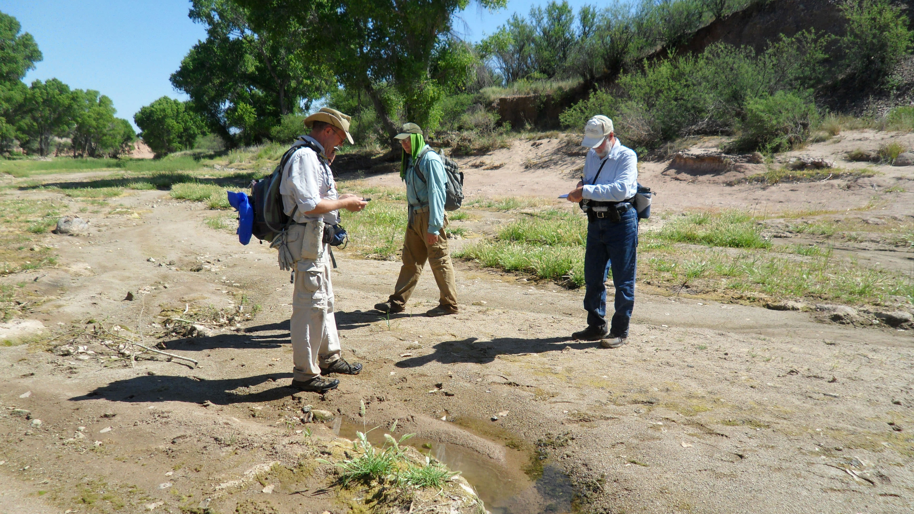
Each year, more than 100 volunteers are equipped with GPS technology, cameras and plenty of water, working along 300 miles of the San Pedro River and its key tributaries to map where the river has water and where it doesn’t. These community scientists are rewarded with wildlife sightings and scenic river stretches. For many, it is an annual event and a labor of love for one of the few rivers in the Southwestern U.S. and northern Sonora that continues to flow all year in many stretches. The lush streamside forests of the San Pedro provide habitat for a diversity of wildlife, including millions of migratory birds.
Given the prolonged drought, it is more important than ever to gather data to assess how water supplies are holding up. Dedicated volunteers hiked under adverse conditions in remote locations in midsummer to map the river and compile the data.
It Takes a Village
Dozens of partner organizations coordinate across the international border for this massive effort that covers more than 300 miles of main stem and tributaries within the San Pedro River Basin. Partners include: Area de Proteccion Bavispe, Arizona Dept. of Forestry & Fire Management, Arizona Game & Fish Dept., U.S. Bureau of Land Management, Cochise County, Community Watershed Alliance, Comisión Nacional de Áreas Naturales Protegidas, Cascabel Volunteers, Fort Huachuca, Friends of the San Pedro River, National Park Service, Naturalia, Pima County, Salt River Project, The Nature Conservancy, Bureau of Land Management, National Park Service, Arizona Game and Fish, Community Watershed Alliance of Benson, Cascabel volunteers, private landowners and many community volunteers.
The effort extends from San Pedro River headwater streams in Mexico to its confluence with the Gila River, a key tributary of the Colorado River. Volunteers also map key tributaries of the San Pedro, including the Babocomari River, Aravaipa Creek, Hot Springs Canyon and many other smaller streams.
2022 Wet-Dry Mapping
The long-term drought that has spread across the Southwest has shrunken water supplies not only in the Colorado River, but also in its tributaries, including the San Pedro River. In many parts of the San Pedro, fewer reaches of the river continued to flow in 2021 during the driest time of year than ever before recorded since volunteers began mapping the river’s flows each summer in 1999. Overall, 22% of the river remained flowing during June in 2021, as compared to 38% in 2020. Approximately 40 tributaries that feed the San Pedro, such as Aravaipa Creek, Ramsey Creek and the Babocomari River, are also included in the wet-dry mapping effort and yielded similar results—40% of these streams remained wet in June of 2020, while only 24% were wet in June 2021.
The results of these river-mapping efforts in 2022—including nearly 300 of miles of the river and nearly 40 of its tributaries in the U.S. and Mexico—will again be summarized and posted in the fall.


Water Snapshot
In 1999, volunteers mapped the first 50 miles of the U.S. length of the upper San Pedro River through the BLM’s San Pedro Riparian National Conservation Area. By 2007, the effort had expanded to mapping from the headwaters in Mexico all the way to the Gila River confluence, collecting data on an average of 130 of the 170 mainstem miles annually.
Since 2007 the percent of wet river miles across the watershed has ranged from 23 to 45 percent. Wet river miles at the higher end of that range followed several notable years where large floods coursed through the river.
In 2018, our 20th year of mapping, 23 percent of the river had surface water, the lowest number of wet river miles in our 20-year record. This low point is consistent with climate, water and drought data recorded throughout the Colorado River Basin. Records indicate early 2018 was the third driest in the Colorado River Basin historic record.
Maps of past wet-dry mapping are available here.
Why is this critical?
Two decades of mapping have helped inform our conservation work on the upper San Pedro. The mapping information, along with USGS research, has helped TNC and its partners design an innovative regional recharge effort to collect stormwater and other water sources and put it back in the underground aquifer to replenish river flows.
The wet dry mapping project informs regional and collaborative water management, including the development of Cochise Conservation and Recharge Network projects. This network includes eight project sites totaling 6,000 acres, including three infrastructure projects that put stormwater or treated effluent back into the ground. Increasing the amount of water stored in the ground benefits both a healthy river and wildlife as well as water supplies for people.
Related articles

San Pedro River
Cross-border collaborations bring lasting results to one of America’s last large undammed rivers.

Water Security for Arizonans
Freshwater resources in Arizona serve as a critical water supply for the people of Arizona, and surrounding areas. Discover how we are addressing water security for people from all communities.

Colorado River Basin
Developing innovative ways to manage water in the Colorado River basin for nature and for 36 million people.