Farming With Nature: Matt Hanson
To tackle flooding and water quality issues, Matt Hanson has taken a new approach to managing his family farm.

When Matt Hanson was growing up, it was not unusual for the family farm to flood. Hanson’s farm is located on the Root River in southeastern Minnesota, about 20 miles south of Rochester in Olmsted County. The family farm flooded once a year or so, typically early in the season; he remembers only a couple of summertime floods.

The Root runs through the 500-acre farm and as a child, Hanson fished there with his grandfather. He remembers mostly catching “rough fish”—carp and suckers.
A challenge came when part of the property started to flood more frequently about 25 years ago. The flooding is caused by a variety of factors: urban and residential development upstream, conversion of floodplain land to farmland, and warmer, wetter weather due to climate change.
Today, it’s not unusual to get a midsummer flood—significant flooding, two to three feet deep across several acres. It’s also no longer unusual for the farm to flood more than once in a season. One year, Hanson recalls, “it flooded four times.”
Quote: Matt Hanson
If you’ve got less dirt in the water, the trout survive better. If you’ve got muddy water, all you get are rough fish.

The floods have become more damaging. When the Root floods, it turns black with sediment and topsoil from the farms. These sediments end up in the Mississippi River. Sand dunes that look like snowbanks overwhelm planted areas. The Hansons have had to clear sand before they could roll through equipment to till the land.


Hanson grows corn but was unable to plant soybeans or small grains because of the flooding. Corn can withstand some early-season flooding, but other crops cannot. He tried hay and pasture, but neither worked.

Hanson knew he had to make a change. He’s a conservation-minded farmer, so he began to work with public and private partners in 2010 to implement three solutions. First, he pursued flood mitigation strategies along the Root’s riverbed. Next, he started planting cover crops to minimize erosion. Finally, he placed conservation easements on the floodplain to protect the land where it was ill-suited for farming, followed up by installing a thick bank of natural grasses on 80 acres along the Root.
Hanson describes the native and prairie grasses as “a rough-looking field of wheat.” Initially, he was concerned about how the grasses would fare in the flood-prone area of his farm. The native grasses cost about $300 an acre to plant, and he was worried they’d be washed away. But they took hold and have survived several floods. “There was nothing to slow the water down. By putting the land in grass, there’s no erosion and there haven’t been any washouts,” Hanson says.

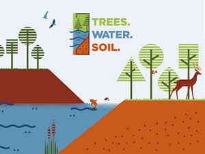
Trees. Water. Soil.
Explore the nature-based solutions growing all around us. Things like forests, rain gardens and cover crops will all be essential in the climate fight!
Hanson also planted cover crops. These cover crops, which are planted to reduce erosion during the fallow season between main crops, protect the water quality in the Root River, the streams along the river and the Mississippi River. Cattle can also graze on cover crops later in the season, reducing feed costs and saving labor. Another benefit is their value for wildlife. Hanson has seen a marked increase in deer, turkey and coyote. During one recent, bitterly cold winter, pheasants survived well in the sorghum he planted as a cover crop. Hanson left 40 yards of sorghum for them to use as shelter and occasionally distributed feed for them to eat.


Last, Hanson worked with the Olmsted County Soil and Water Conservation District and The Nature Conservancy to place a conservation easement on over 100 acres through the Minnesota Board of Water & Soil Resources’ Reinvest in Minnesota Program. A Conservation Partners Legacy grant also helped pay for the easement, a legal agreement that prohibits certain activities like development on a piece of land in perpetuity. In exchange for giving up these rights, the landowner receives a payment. Payment from the easement allowed Hanson to buy more land with lower incidence of flooding.
Want More Stories?
Get new stories and timely action alerts so you can speak for our trees, water and soil.
Sign up
Hanson also agreed to place public access easements at two points along Highway 30 and a couple of county roads to allow anglers to reach the water. The area attracts a large number of anglers each year. Hanson no longer fishes, but when he’s checking on his cows, he sometimes visits with people who are fishing at these sites. He’s learned that trout and bass flourish here— a significant improvement over the carp and suckers he reeled in with his grandfather.
“If you’ve got less dirt in the water, the trout survive better,” Hanson says. “If you’ve got muddy water, all you get are rough fish.” Those who fish in the area appreciate Hanson’s decision to improve habitat for fish and wildlife and often thank him for making the river more accessible for the public.
More Stories

Conserving a Way of Life: John Reed
When John Reed began to think about having his own business, he acquired land and started raising cattle. He wanted to grow his herd and business, but confronted obstacles ranchers often face.
Trees. Water. Soil.
A campaign by The Nature Conservancy that explores the climate solutions that exist all around us and the Minnesotans who are already using them.

Growing Solutions: Highland Family Farms
Kristin and Pat Duncanson, along with two of their children, produce corn, soybeans, pork and cereal rye—all while employing soil health and smart nutrient management practices.